December 12 – Weather action picking up
This very cool, dry and quiet stretch of weather is ending soon. A weak storm system brings snow showers to Connecticut on Thursday, with the best chance of a snow coating in the western half of the state and away from the Shoreline. Fairfield County could see around an inch in the afternoon and early evening. The snow looks fairly light and a coating on the roads is unlikely before mid to late afternoon. The threat of snow showers begins late in the morning (9-11 am) from west to east and continues until early in the evening between 5-7 pm. The map below depicts the area most likely to get a coating of snow, but, even there, it may not happen. This is not a significant weather system and the best bet for anything that could impact travel a bit is in far southwestern Connecticut. Temperatures will be in the low to mid 30s in Connecticut. If you live in Rhode Island or Eastern Massachusetts, you are less likely to see any snow at all, and it will probably be a mostly cloudy and chilly day with temps in the 30s.

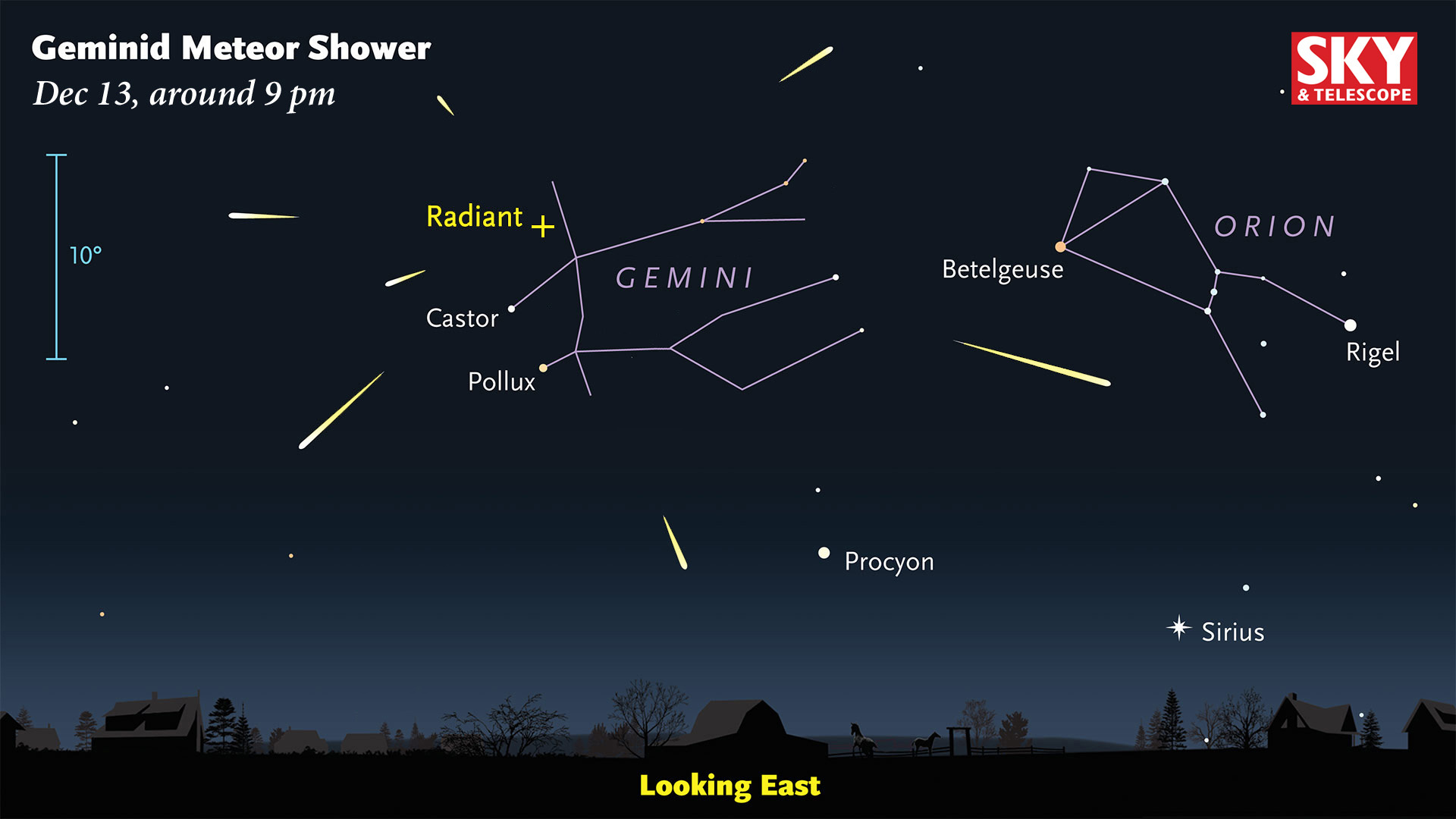
If the skies clear Thursday evening, be sure to check out the Geminid meteor shower. The graphic below shows the best way to view this yearly event. It’ll be cold outside, but if you get to someplace without a lot of lights and let your eyes adjust, there’s a decent chance that you’ll see a few meteors in 30 minutes or less.

Dry weather is ahead for Friday with temperatures in the 30s to low 40s at best. Clouds will stream in during the day, but it likely stays dry well into the evening. Rain may develop by midnight in Connecticut, and after midnight in Rhode Island and Eastern Massachusetts. Showers continue overnight into Saturday morning. Part of this storm may get shunted off to the east limiting the amount of rain that reaches Southern New England. Right now, it looks like a half-inch or less for most spots, with the rain ending from northwest to southeast midday Saturday through the afternoon. The temperature likely reaches the 40s inland and may get to 50 at the coast. There will be a break between storms on Sunday with some clouds and highs in the 40s.
It looks like another storm developing off the Mid-Atlantic coast may come close enough to clip at least part of Southern New England with chilly rain Sunday night into Monday. This is a new development and something I’ll be watching closely. It will take a track that can favor snow at this time of the year, but there’s not much cold air left in the wake of Saturday’s storm, and it should be more rain than wintry precipitation. I’ll be watching it.
A cold shot arrives on Monday night into Tuesday and stays through the midweek. It will be blustery and bitter on Tuesday. It may not reach 30° inland, with wind chills in the teens. Wednesday is chilly and dry, but not as cold or windy. The temperature moderates late in the workweek with rain likely sometime around next Friday.
Overall, after a sleepy stretch, it looks like the weather action is picking up. Now, if we can just get one inch of snow (nothing more) between 1-5 a.m. on Christmas we’ll be in great shape 🙂


