December 13 – Unsettled Weekend
A few slippery spots are possible overnight following some light snow showers and flurries on Thursday afternoon and early evening. The temperature will be in the mid 20s to low 30s overnight. Friday looks like a gray day with milder temperatures. Expect it to reach the low to mid 40s for a change. It will not exactly feel warm due to the dampness in the air. Patchy mist is possible.
A storm system splitting in two will be bothersome this weekend. Expect showers, especially near the coast, Friday night into early Saturday. It does not look like a big soaker, and it’s possible the steadiest rain stays offshore. Temperatures will be in the 40s. After a wet start, it should gradually dry out on Saturday. Look for highs in the mid to upper 40s.

The best chance of 1″+ snow Sunday into early Monday is in interior Southern New England
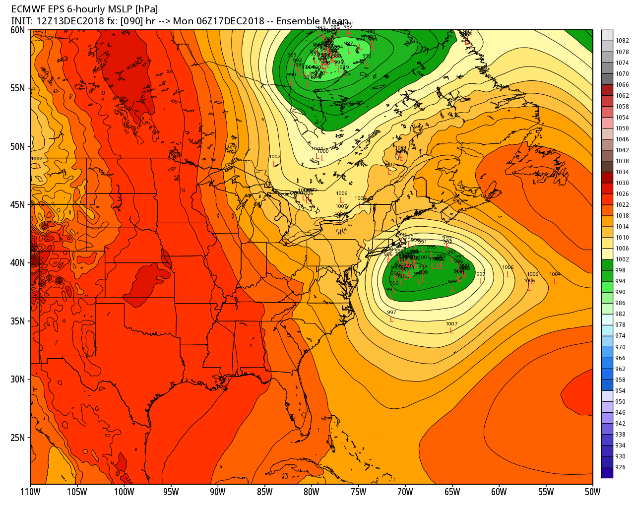
The second part of the storm arrives on Sunday and lingers through Sunday night. The developing low pressure off the New England coast will bring rain, and possibly snow, Sunday into early Monday. At this point, it looks too warm for all snow and an impact event in most of Connecticut, Rhode Island, and Massachusetts. The track and intensity are important, and a more significant snow event is still on the table, it’s just not the most likely scenario. Expect raw rain showers and temps in the upper 30s to low 40s in the I-95 corridor to the coast. Inland, there’s a better chance of snow/rain mix changing over to snow Sunday night. The models are predicting light precipitation, but I think it could be heavier if the storm gets organized quickly. I will keep you posted.

An organized storm off the SNE coast Monday morning. The track of the storm is important. If it’s anywhere close to the coast, then it will be rain because there’s not much cold air in New England as it passes by. A bit farther south of Nantucket, and it could hit a sweet spot that brings precipitation, but also manages to lock in colder air.
The storm moves away early Monday with temps in the 40s under dry skies likely Monday afternoon. A cold and blustery blast arrives on Tuesday with highs closer to freezing. It still looks like it will gradually get milder in the midweek, with more rain possible around Friday of next week.
Considering how quickly the Sunday-Monday forecast changed, I’m hesitant to make any call on a white Christmas at this point. The overall pattern is not favorable for cold/snow, but it does not take much of a shift to get at least a bit of snow at this time of the year.


