Enjoy Thursday’s tranquil weather because it gets wet and wild on Friday as a strong storm system brings periods of heavy rain, strong wind, and near-record warmth to Southern New England. The storm system will move away Friday night, and the weekend features dry weather with it turning colder on Sunday. A touch of light snow is still possible Monday morning, but it does not look like much, and it may even be light rain showers near the coast. Christmas Day looks quiet and seasonably cold.

Rain, heavy at times Friday afternoon and early evening
After a frosty start, the temperature will climb into the mid 40s to low 50s on Thursday afternoon. Sun will give way to clouds late in the day. The wind will not be too strong – generally out of the southeast between 5-10 mph. Showers arrive Thursday evening, with a better chance of steady rain by dawn on Friday. The temperature rises overnight into the 50s by Friday. The best chance for heavy rain on Friday is midday into the afternoon in Connecticut, and late-afternoon through the evening in Rhode Island and eastern Massachusetts. Most of the rain should be gone by Saturday morning, but a few showers could linger. Expect the temperature to hover near 50 for a while. Rain totals between 1-3″ are likely in Southern New England, with the best chance of 2-3″ in Connecticut. Localized street flooding is possible due to runoff on Friday afternoon/evening.
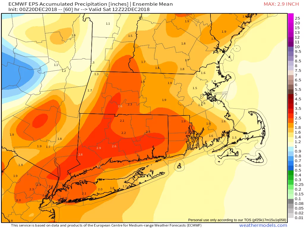
EPS model predicting 1-3″ rain in Southern New England on Friday
Other aspects of the Friday storm include strong winds and near-record warmth. The wind will be screaming off the deck, and some of the powerful gusts could mix down to the surface. 45-55 mph southerly gusts are possible near the coast during the day. The wind will not be as strong by late Friday. If it gets warmer than 60° in Bridgeport, Hartford and Providence, then a new record high temperature will be set. The current record is 60° set in 1957 in all three cities, and most recently tied in Providence in 1999.
Sunday looks like a quiet and seasonably cold day with highs in the upper 30s. A weak system moving through late Sunday night into Monday morning could bring a few rain/snow showers. There is about a 20-40% chance of an inch of snow, with the best bet close for snow close to the CT/NY border. The 20% chance is over RI and E MA. It looks dry for Santa on Christmas Eve as temps settle back into the 20s. Christmas Day will be dry and seasonable with highs near 40.
I will take a look at the forecast for the last week of December and early January later today or on Friday. Have a great day!


