January 1 – Snow/rain early Thursday
Happy New Year! 2019 got off to a very mild start with temperatures in the 50s across the board on Tuesday. The gusty wind did not do too much to diminish a great day to go for a walk or run. It will turn a bit colder for the second day of the year, with temperatures dipping into the 20s by dawn, and only into the mid-upper 30s with some sun on Wednesday.

Radar forecast for 5 am Thursday
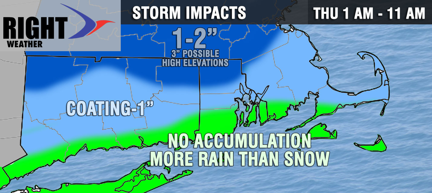
An Alberta Clipper system brings snow/rain to Connecticut, Rhode Island, and Southeastern Massachusetts late Wednesday night into Thursday morning. The nuisance system could slow the Thursday morning commute – especially inland. It may bring 1-2″ of snow inland, with a lower chance of accumulation in the I-95 corridor to the coast due to milder temps and a chance for rain. The threat of snow/rain is from shortly after midnight until around noon. The best chance of accumulating snow is between 3-7 am.

Dry weather returns Thursday afternoon and continues through Friday. Look for temps in the 40s both days. Another storm system arrives late Friday night and lasts through Saturday. It looks like rain with a track close to the coast and no cold air around. It could bring another inch or so of rain to some towns. Highs will be in the 40s again.
Sunday should be a dry day with seasonably mild temps in the 40s and some sunshine. It looks dry and colder on Monday. I’m watching an Alberta Clipper for more light snow potential in the middle of the week. In fact, there could be a couple of systems that come through in the midweek.


