The deep freeze is slowly easing as the temperature rebounded into the 20s on Tuesday. It will actually be warmer than normal by Wednesday afternoon as the temperature slowly climbs through the 30s into the low 40s by late in the day. Expect some clouds on Wednesday, so it may not feel too warm during the day. There is a very low chance of a light spotty rain/mix shower, and a better chance that it stays dry through sunset.
Rain showers arrive Wednesday night with temperatures ranging from the upper 30s to mid 40s through midnight. The wind will pick up out of the south after midnight, and the temperature may reach the 50s by dawn. Rain may be heavy at times on Thursday. It will be a gusty day, and there is the potential for gusts over 40 mph – especially near the coast. Another 1-2″ of rain is possible from this storm system, and that may be enough to cause street/stream flooding after the heavy storm this weekend.
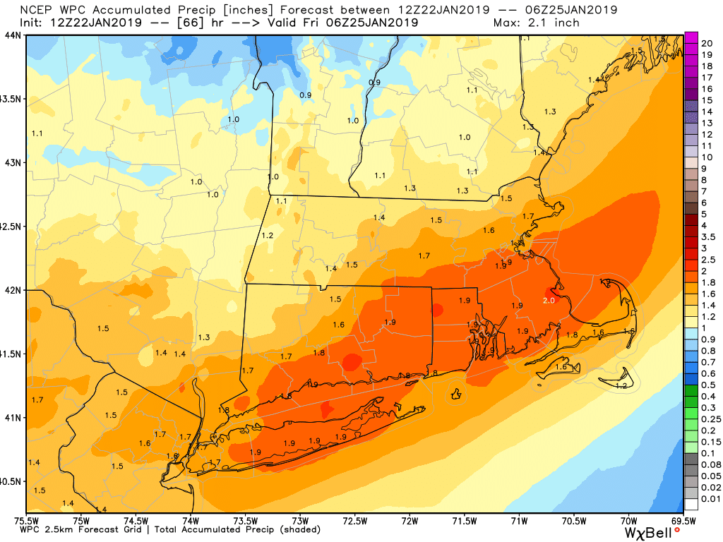
Rain ends from west to east during the late afternoon and early evening. Cold air follows the storm system and the temperature will likely fall below freezing within 4-6 hours after the rain ends. It will be a close call for the pavement to dry out before sub-freezing air arrives. It will not be like the flash-freeze that we saw on Sunday, but some icy spots are possible from late in the evening through the night.
Quiet weather is likely from Friday through at least the first half of the weekend. Look for highs in the 30s on Friday with a fresh breeze. Saturday will be a chilly day, with highs in the upper 20s to low 30s, and lows in the teens.
Uncertainty early to middle of next week
There is still a decent amount of uncertainty surrounding the forecast for early next week. A weak Alberta Clipper could bring light snow/mix late Sunday after a seeing highs in the 30s. It does not look like much precipitation. A stronger storm may eventually form near the Eastern Seaboard in the early to middle part of next week. There will not be a lot of very cold air around at the time, so an all-snow event seems unlikely. The overall weather pattern is fairly active into early February, and early signs are that there could be another storm to deal with around February 1-3.


