The weather has not been spectacular this May in Southern New England, but history tells us that it’s not necessarily a perfect month weather-wise in the Northeast. It’s a transitional month with cool ocean water influencing the weather anytime the wind turns onshore. The month will go in the books with near to slightly cool temperatures and near normal rainfall.
June begins with a relatively dry weather pattern likely in the Northeastern United States. A clipper system could bring a few showers in the middle of next week, but there is not likely to be a very unsettled pattern in the first 7-10 days of the month.

The EPS predicts relatively dry weather in the Eastern US in the next two weeks
The temperature will be very warm in the Midwest, but not as warm in the Northeast – including New England. Look for near-normal temps in the first week of June.


Long-range models show the month as a whole averaging relatively dry and near-normal temperatures.


The Atlantic Hurricane season does not officially begin until Monday, June 1, but there have already been two named storms, and a third could form in the next 48 hours. Cristobal may develop in the central Atlantic Ocean – it’s absolutely no threat to land.

Another area to watch is the western Gulf of Mexico. A disturbance moving through Central America could become a tropical storm sometime in the next week. The EPS has the odds at close to 50/50 for a tropical depression to form.
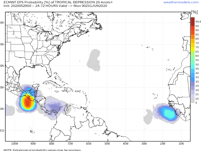
We’re expecting a lot of action in the tropics this season, but it only takes one storm to really mess things up in Southern New England. The two systems that could form in the next 10 days will not be factors for our area.


