The weather will be somewhat unsettled from Monday night through Tuesday night as a front hangs around on Tuesday and a storm center moves by Tuesday night. Expect tons of clouds on Tuesday with a cool feel inland and milder/muggy near the coast. The day begins with patchy dense fog and drizzle/mist. It does not look like a rainy day, but a few showers cannot be ruled out. The better chance of rain is at night as the storm center moves through northern New England and drags a cold front through Southern New England.
Wednesday should become a pretty nice day after a gray start. Look for highs in the 60s to mid 70s depending on how much sun breaks through. It stays relatively mild and dry on Thursday with highs in the 70s. The temperature falls back into the 60s with dry skies on Friday and Saturday. As mentioned in the video, the long-range outlook is for another warm-up in the early to middle part of next week. I’m also watching for a storm to develop near the Southeast US coast. It’s unclear if it will be drawn far enough north to bring rain to New England late next week.
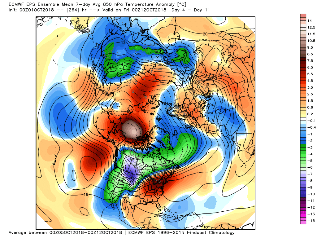
Warmth in the Eastern US next week


