July 29 – PTC Nine bears watching
The storm known as Potential Tropical Cyclone Nine (PTC9) is moving through the Caribbean on Thursday. It will bring squally rain to nearly all the islands before getting close to Florida this weekend. It is not yet a tropical storm, but could become in the next 24 hours. If it gets a name, it will be Isaias – ees-ah-EE-as.
The interaction between the storm and Caribbean islands, including Puerto Rico and Hispaniola, will likely prevent the storm from becoming a hurricane. The track of the storm will take it near South Florida by the middle of the weekend. The big question is will it go west of Florida, over Florida or east of Florida? The most problematic track for Southern New England is if the storm stays east of Florida, but close to the Southeastern US coast.
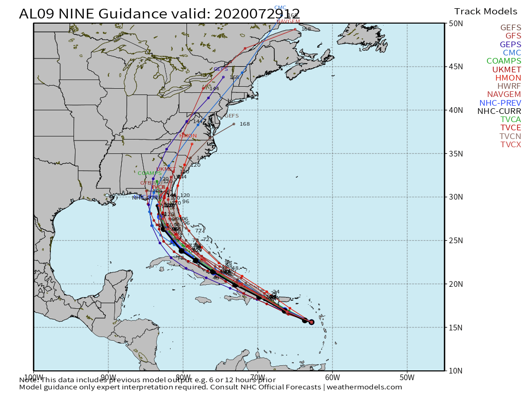
As you can see below, there is not a great agreement among the computer models on the ultimate track of this storm. The different lines represent computer model tracks, and the lines that are near the East Coast not only represent a track closer to New England, but a stronger storm. At this point, I see about a 25% chance of PTC9 (Isaias) taking this track somewhere along or off the East Coast, but close enough to have an impact in Southern New England.
If the storm stays off the East Coast over the relatively warm water of the Atlantic Ocean and Gulf Stream with no land interaction, it’s understandable to see why it would strengthen. It’s also quite possible that a track off the East Coast would eventually send it out to sea without much impact for New England. For now, I would not get too caught up in the potential for PCT9 (Isaias) to head for New England, but I would keep an eye on where it’s going in the next few days.


