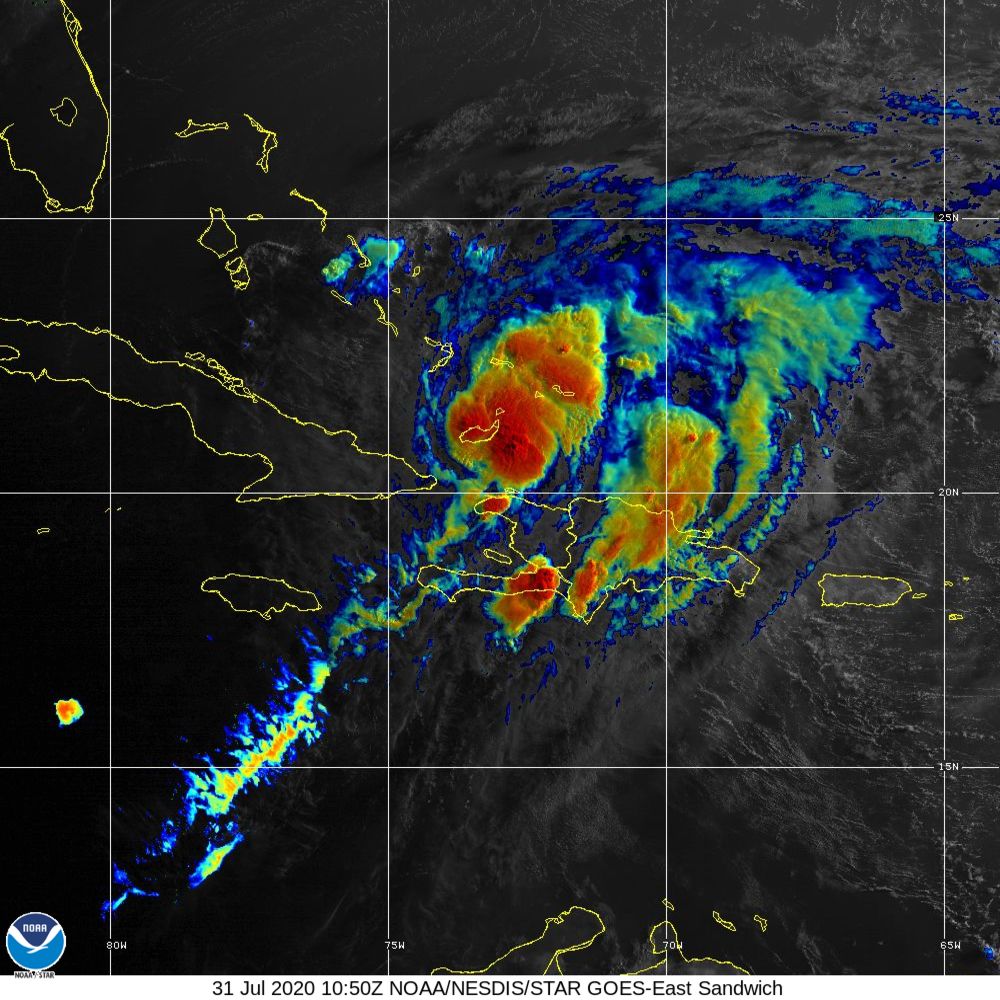
Hurricane Isaias continues a Caribbean tour on Friday as the storm moves away from the Hispaniola and gets over very warm water near the Bahamas. The minimal hurricane may strengthen to a strong Cat 1 or Cat 2 in the next couple of days as it nears Florida.
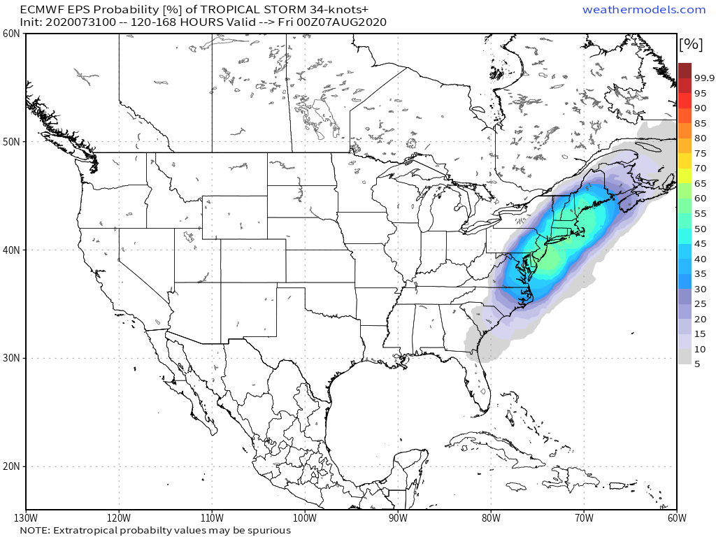
Computer models are in good agreement that the storm will ride somewhere along the eastern side of Florida and up the Eastern Seaboard. The exact track of the storm is very important to the forecast in Southern New England. At this point, even given the uncertainty about the storm’s intensity, it is likely that there will be some wind/rain from Isaias in Southern New England early next week.
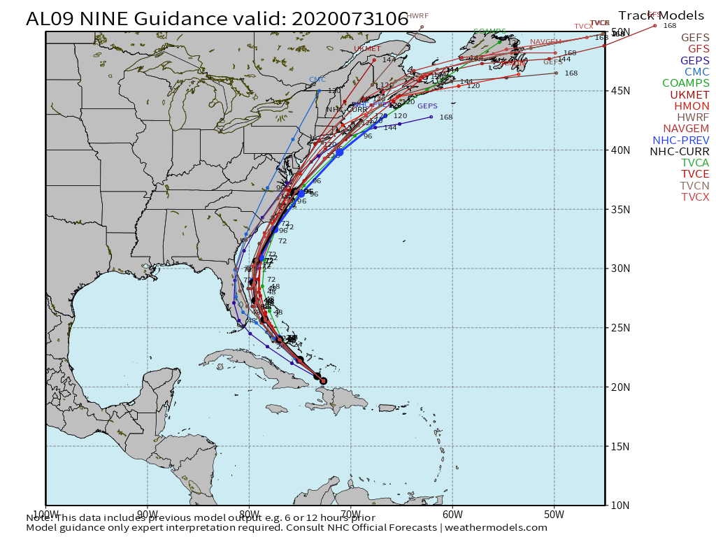
The timing is still questionable, but the most likely time frame to focus on is between early Tuesday and early Wednesday. There are some models that bring the storm to New England as soon as late Monday night and others that hold off until midday Wednesday.
It’s too early to speculate about detailed wind, rain and coastal impacts because the center of the storm could be as far west as NY or as far east as off Nantucket. The exact track is extremely important in determining local impacts. Here are some of the potential impacts based on a tropical storm passing over New England.
Rain – 1-3″ of rain is most likely, with a low risk of higher totals. The storm should be moving quickly as it passes by, and that will limit totals. There are scenarios that could bring more/less rain. If there’s a plume of moisture ahead of the storm, then higher totals are possible in some areas. If the storm passes west of where you live, then you may get less than an inch of rain.
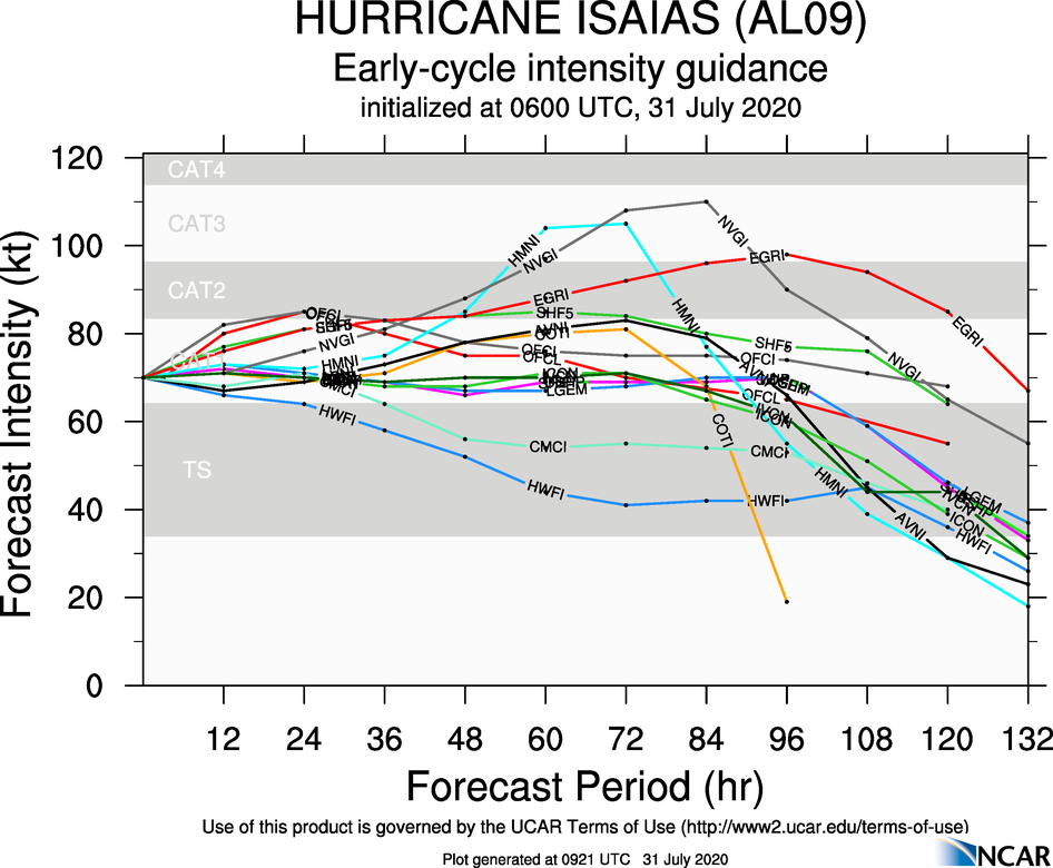
Wind – 30-50 mph winds seem most likely given what we currently know about the storm. The strongest winds are likely along and slightly east of the storm’s center. This projection should be taken with a couple of grains of salt since hurricane intensity forecasting is notoriously inaccurate. You need to look no further than last week when both Gonzalo (too strong) and Hanna (too weak) had poor wind forecasts. At this point, winds less than 30 mph and stronger than hurricane force are still on the table. The 30-50 mph range represents a most likely scenario.
Coastal – Storm surge flooding will be highly dependent on the storm’s track and intensity plus the tidal cycle when it arrives. Some surge is possible if it’s a strong storm passing over New England during high tide.
I will continue to keep you updated this weekend as the storm nears the Southeastern United States.


