August 10 – Not as hot later this week
The heat and humidity continues early in the week in Southern New England. Look for temps near 90, and high humidity will make it feel more like 95-100 Monday and Tuesday afternoon. A few afternoon t-storms cannot be ruled out, but it looks mainly dry.
It turns just a bit cooler on Wednesday with highs in the mid 80s to near 90. After that, the high temperature should settle back into the low to mid 80s (near normal) from late in the workweek through the weekend. There is also an increasing risk of showers and thunderstorms late in the workweek.
The average temperature will be 4-8 degrees warmer than normal in the next 7 days, with most of that coming in the next 3-4 days. After that, it looks just slightly warmer than normal through next week. It does not look like there is anything very cool for this time of the year coming down the pike.
A bit less dry next two weeks
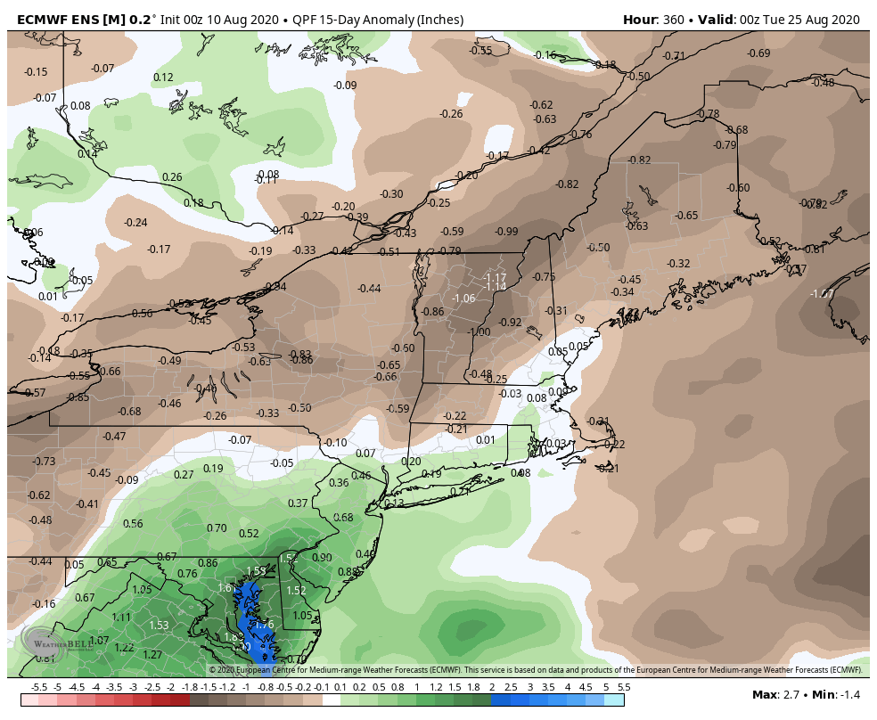
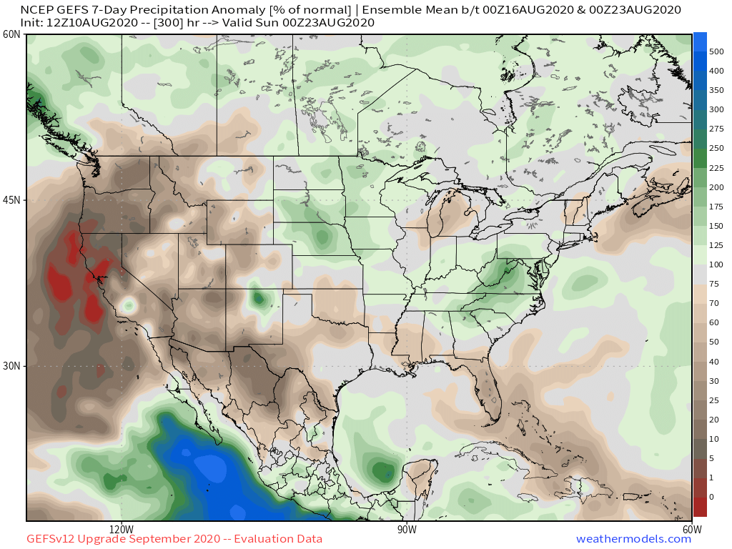
Even though there will likely be some showers/storms around later this workweek, the overall weather pattern does not look particularly wet for the next couple of weeks. The EPS model is predicting near-normal rainfall in Southern New England and the brand new GEFS ensemble is also predicting near-normal rainfall. There will be a lot of disturbed (wet) weather over the Mid-Atlantic in the next two weeks, and it’s still possible some of that could shift north and bring welcome rain to SNE.


Tropics heating up again
The tropics have temporarily quieted down after Isaias, but another surge of tropical systems is likely in the second half of August. Whether one of them makes it up the Eastern Seaboard remains to be seen. The short-term weather pattern is wholly responsible for bringing a system to New England – as we saw with Isaias. At this point, even if Josephine forms in the eastern Atlantic Ocean, it’s no threat to land.


