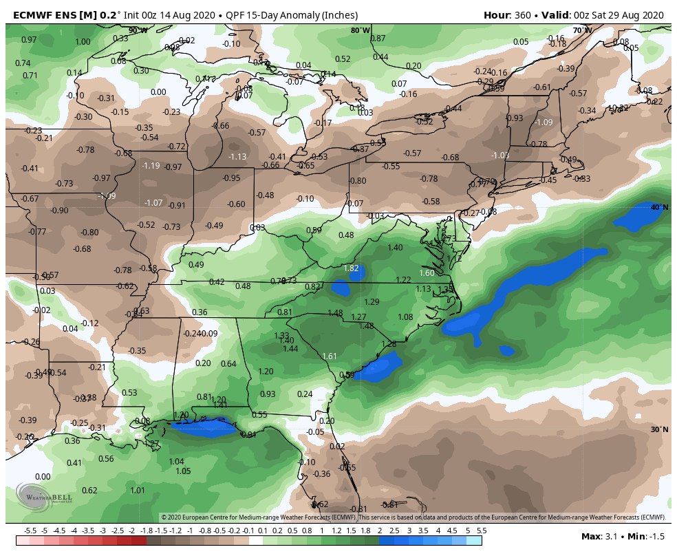
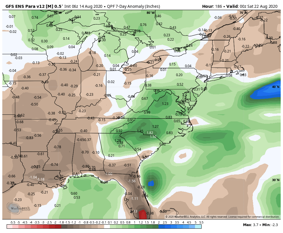
There was beneficial rain near the coast of Southern New England on Thursday. It has been a dry summer and Rhode Island, Southeastern Massachusetts and most of inland Connecticut are in a moderate drought. Unfortunately, it looks like there will be near-misses in the next 10-14 days, and significant widespread rain is unlikely.

Most of the rain in the next 1-2 weeks will stay over the Mid-Atlantic and Southeastern United States. After a mostly hot stretch in the end of July and start of August, the weather will be cooler over the weekend with an onshore breeze. It should get back to seasonable or warmer than normal in the upcoming week.
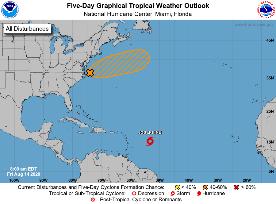
The hyperactive tropical season continues with Josephine churning in the Atlantic Ocean. That storm will likely weaken without impacting land. There is also a disturbance near the Mid-Atlantic coast that will drift out to sea south of New England. There is a low chance it comes close enough to bring rain to coastal New England, but the odds favor it staying far enough offshore that it stays dry in New England.