Tropical Storm Isaias may briefly become a hurricane on Monday before making landfall late Monday along the South Carolina or North Carolina coast. It will be a tropical storm transitioning to a post-tropical cyclone when it passes by New England Tuesday night.
The storm will not to cause tremendous destruction in Southern New England. If it hangs together as it moves through the Mid-Atlantic it could bring a few inches of rain to western Connecticut, and isolated wind gusts over 50 mph to the coast of Southern New England. If it’s completely falling apart, then peak wind gusts will likely be in the 30-40 mph range causing little, if any, damage. A notable storm surge is unlikely. The center of the storm will likely be far enough west and passing by near low tide to limit the coastal flooding potential. Here are the impacts in a nutshell:
Rain potential
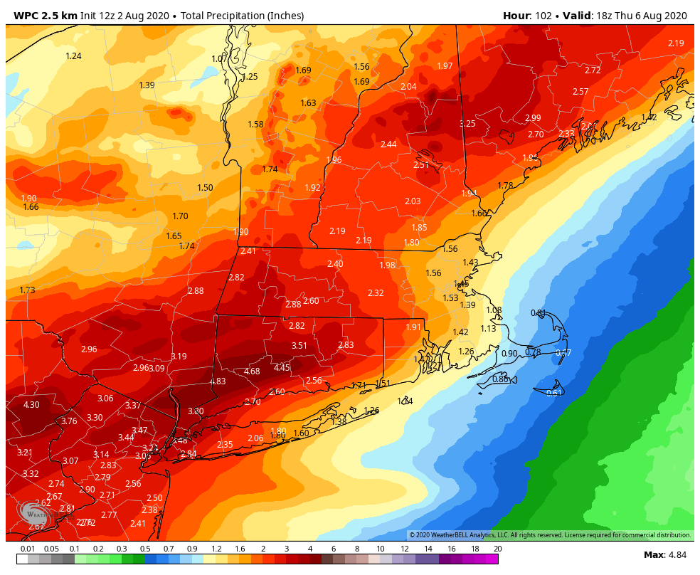
I expect areas outside of western Connecticut to get less than 1″ of rain from Isaias. I think the rain forecast for eastern CT and RI is too high, and I expect 0.4-0.8″ from Isaias over RI. These areas will likely be on the drier and windier side of the storm as it passes by.
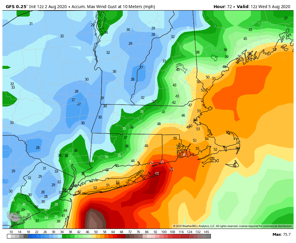
Wind Impact
Coastal Impacts
As mentioned above, the coastal impacts should be limited from this storm. It is not a huge storm, and it will be moving quickly when it races by. The passage of the storm’s center is not expected to coincide with high tide. It looks like a splashover to minor coastal flooding event for south facing shorelines.
Timing
Showers are possible ahead of the system on Tuesday, but I do not expect steady rain until Tuesday night – and that’s mainly along and west of the storm’s track. It will be showery throughout to the east of the storm track, which includes most of RI and all of SE MA. The heaviest rain in western CT is likely Tuesday night.
The strongest winds are likely from late Tuesday evening until before dawn on Wednesday.
The storm will be moving quickly, so you can expect dry skies by dawn on Wednesday. It will be partly sunny day with pop-up showers possible.


