A series of cold fronts keeps a slight threat of showers in the forecast into early Friday before dry and gradually cooler weather arrives for the Labor Day weekend. Look for highs in the 80s on Friday, then likely in the 70s to near 80 Saturday through Monday.
While the dry and pleasant Labor Day weekend is great news for anyone who has outdoor plans, it’s not so great as far as the drought is concerned. A big chunk of Southern New England is under a moderate drought, and an increasing number of communities are facing severe drought conditions.

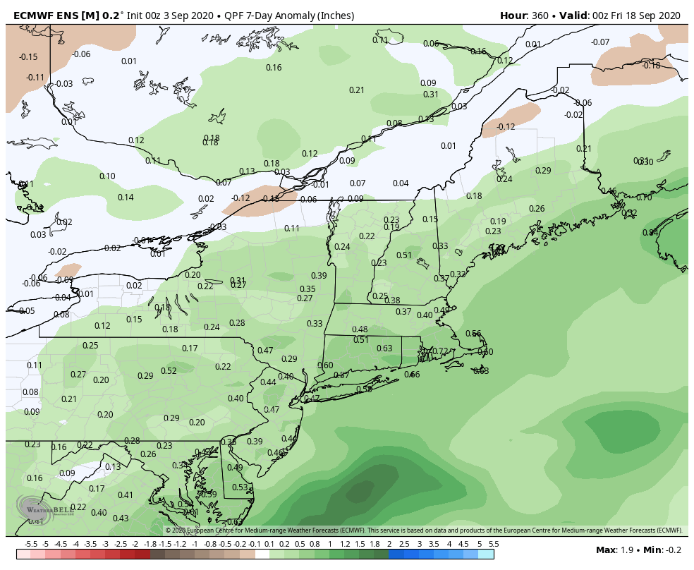
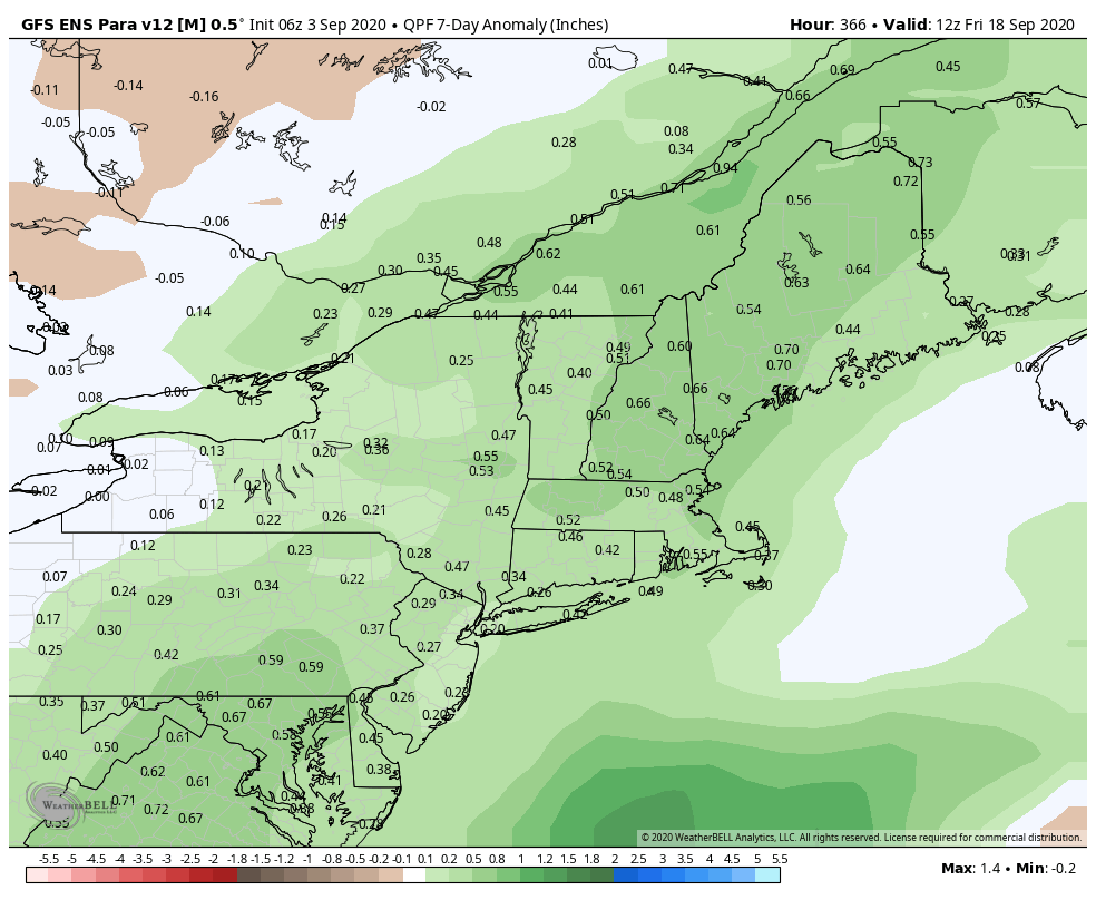
Mainly dry weather is likely into the middle of next week, but there are signs that it will get wetter in mid to late September. The 8-14 day outlook features above normal precipitation in Southern New England from both the GEFS and EPS models.
Tropical Depression Omar is weakening in the Atlantic Ocean and is no threat to land. Nana made landfall in Belize early this morning as a hurricane and is weakening inland while bringing heavy rain to Central America. The next named storm may form in 2-5 days in the Atlantic Ocean. Paulette is the next name on the list. The EPS model suite shows a high likelihood of more than one named storm in the Atlantic Basin in the next 15 days, but as you can see in the image below, of the 50 model members, none bring a storm to the Eastern Seaboard.

We are nearing the climatological peak of hurricane season, and any storm that forms in the Atlantic is worth keeping an eye on.


