It will be a mild end to the week with dry skies into Saturday morning. Expect highs near 50 on Friday. Rain showers develop by midday Saturday and continue in the afternoon. Most or all of the rain will end by Sunday morning, and it will likely be dry and mild on Sunday with highs in the 50s.

A storm system moving through the Southeastern United States this weekend will likely move out to sea south of Southern New England, but it’s not a total lock that the storm will miss. At this point, there’s a low chance of rain/snow on Monday as that storm passes by.
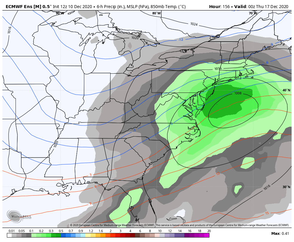
There is a lower chance that a storm in the midweek will miss. It’s still early, but most computer models agree on a storm bringing snow and/or rain to Southern New England next Wednesday-Thursday. It’s too early to speculate very much about details. There will not be a ton of cold air, so the track of the storm is important. A track close to the coast would bring rain to the coast and a mix to some inland areas. At this point, just know that the weather looks active in the middle of next week.
It looks like there could be another system that follows late next week. Once again, it’s impossible to know exactly how it will play out, but it speaks to the active weather pattern in the Eastern United States in mid-December. The colder and active pattern suggests a good potential for more than six inches of snow in the couple of weeks leading up to Christmas.


