It looks like the major midweek storm will come together and bring some heavy snow to part or all of Southern New England. As of midday Tuesday, computer models are trending north with the heaviest snow. If the trend continues, it looks like sleet could limit the snowfall totals in the I-95 corridor to the coast.
A heavy precipitation event is ahead for Southern New England Wednesday night into Thursday
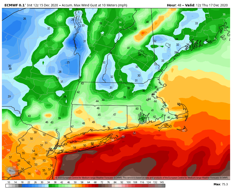
The brunt of the storm is expected between midnight and mid-morning on Thursday. Peak winds over 40 mph are possible near the coast, and if it’s all snow, there could be power outages due to downed trees and power lines.
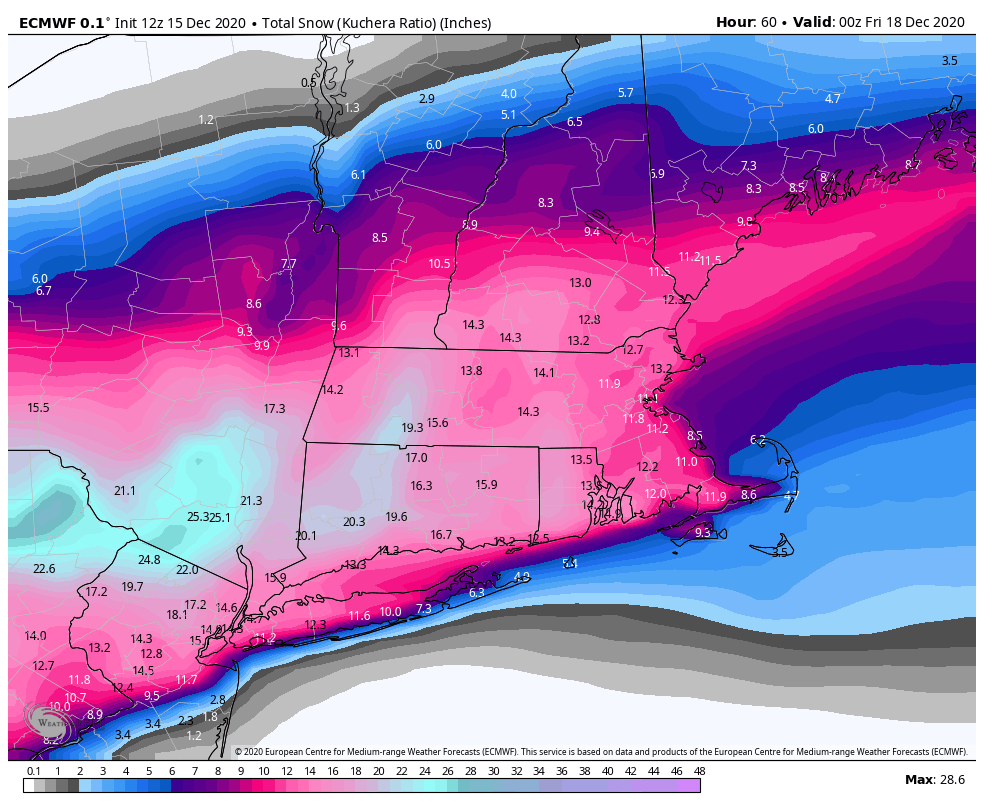
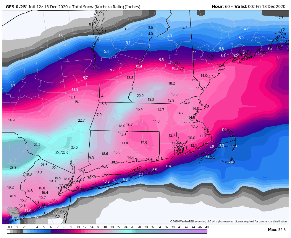
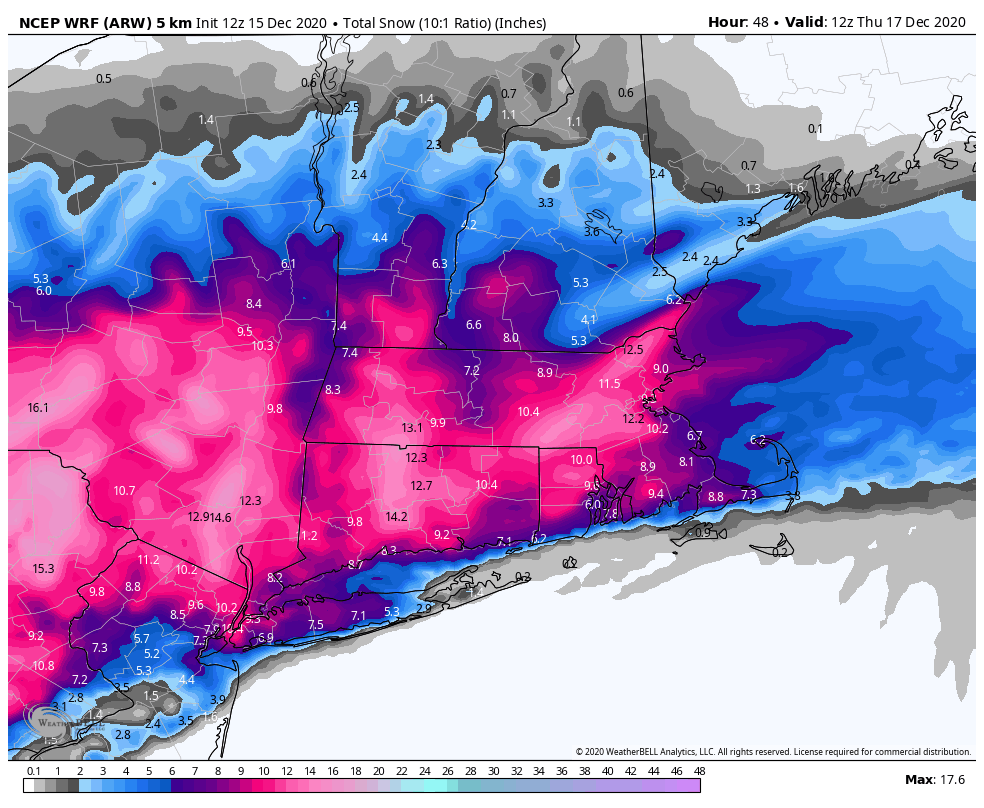
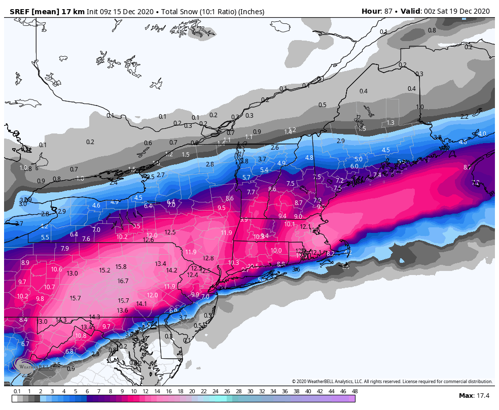
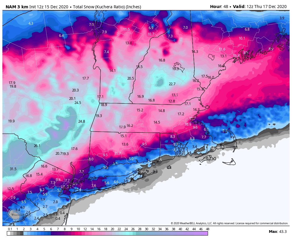
I favor the heaviest snow from Danbury, CT to northern RI to the north shore of Boston. The following maps show some computer model predictions. They are not official forecasts.
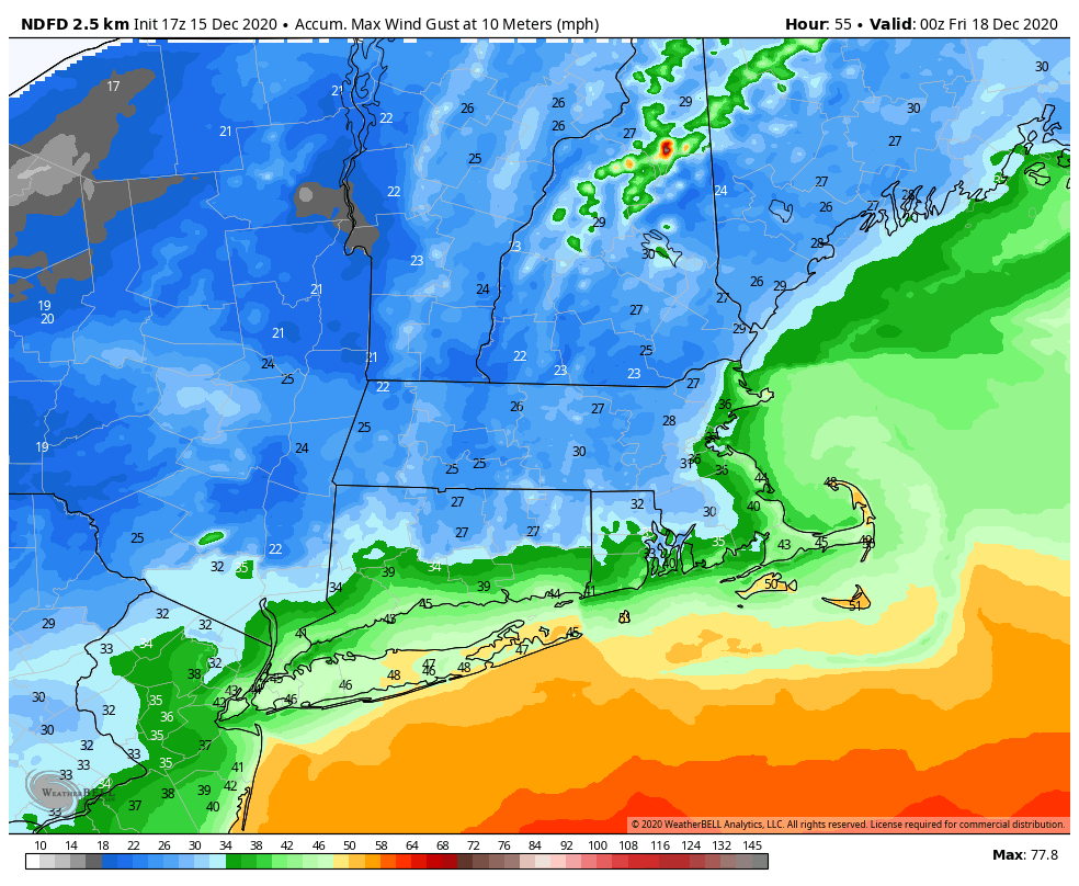
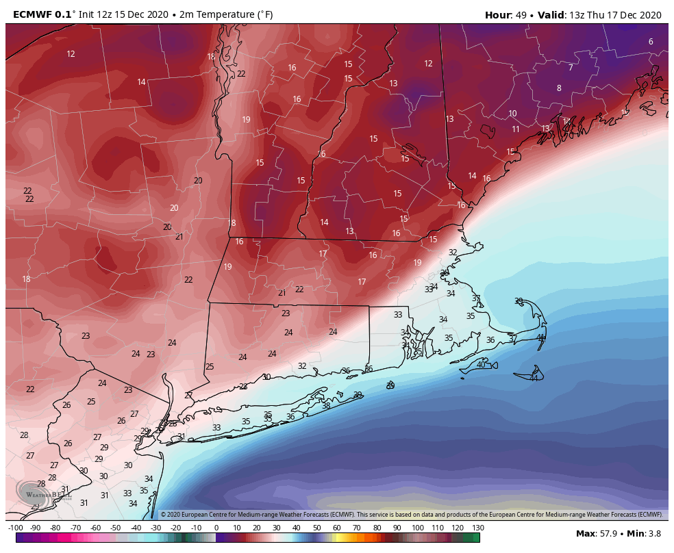
European model – totals seem a bit too high overall, and especially near the coast where some sleet is possibleGFS model – big shift north with higher snow totals in recent runs. This was the model that had a more coastal storm two days ago. Think totals are slightly high, but overall scheme looks good.NCEP WRF – might be a little on the low side in hardest hit areas, but the idea of heaviest totals away from the coast makes sense. SREF Mean – Because it’s an ensemble mean, there are no real extremes. Has the jackpot near Plymouth, MA. I think it’s probably north of there. NAM model – has sleet really cutting into the snow totals near the coast and a big fluff factor over New Hampshire due to very cold temps. I think it’s got the idea, but probably a bit too much sleet near the coast, and max totals near 25″ in central NH may be too highEuro peak wind gusts – Probably a bit too high near the coastNWS peak wind gusts look good with some 40+ mph near the coast – watching for power outages mainly in those areas if snow is stuck to treesThe coastal front is clearly defined on this Euro temperature map. Look how it’s 17° in Worcester and 33° in Smithfield, RI. The heaviest snow is typically near the coastal front, and if it’s this far inland, then there will probably be some sleet in RI and SE MA
The bottom-line is this will be a significant December snow event for a big chunk of New England. The exact track will determine whether it’s a big snowmaker for the coast or if sleet keeps the totals down. Quiet weather follows in its wake on Friday and Saturday. An Alberta Clipper could bring rain/snow showers late in the weekend.
The overall pattern does not look as snowy as we get closer to Christmas, so even if it’s a widespread 8″+ event, there will have to be no big warm-ups or rain events next week to keep snow on the ground for all of Southern New England on Christmas day.