I talked about the potential for slow-moving weather systems near the New England coast in mid-April in the last update on rightweather.com. It looks like that will come to fruition later this week as a storm develops and slowly spins away from the coast late in the workweek. In a worst-case scenario, there could be accumulating snow at the higher elevations of interior Southern New England. While some snow could fall in the coastal plain, a wintry impact is highly unlikely given the relatively warm temps near the surface.
Dry weather is in the forecast for Tuesday and Wednesday. An upper-air low pressure system moving through the Great Lakes will spawn a secondary low near the Delmarva Peninsula early Thursday. That storm will slowly move northeast off the SNE coast Thursday and Friday. The spring Nor’easter has the potential to bring 1-2″ of rain to Southern New England. Winds may gust to 40 mph near the coast. While snow is unlikely for most of Connecticut, Rhode Island and Southeastern Massachusetts, the temperature will be unseasonably cool with it falling from the 50s on Thursday morning to the upper 30s to low 40s.

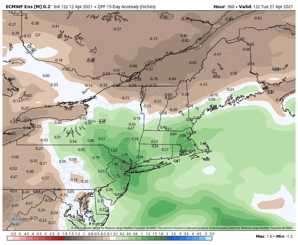
Rain is likely Thursday and Friday. The weather has been very dry in Southern New England, so a good two inch soaking would be welcomed over 48 hours. The storm system moves away on Saturday with dry weather likely for the rest of the weekend. Another storm may develop along the Mid-Atlantic coast early next week. The overall weather pattern looks fairly unsettled in mid to late April, and that could bring beneficial rain.