The workweek begins with another threat of pop-up showers and thunderstorms over Southern New England Monday afternoon. The risk of severe weather is low. Temps will be in the 70s. There is a lower chance of scattered showers/storms on Tuesday, but it’s not quite zero.

Look for warm weather in the middle of the week. Highs could be well into the 80s inland. A breeze off the water will likely keep the coast in the 70s. Dry weather is expected Wednesday and Thursday.
Shower and thunderstorm chances increase again late in the workweek and/or next weekend. It’s early, but the best chance of rain in the upcoming week looks like Saturday. Highs will fall from the 70s/80s to the 60s/70s next weekend, depending on where the front sets up. It’s possible eastern New England could be stuck in the 60s Saturday and Sunday.

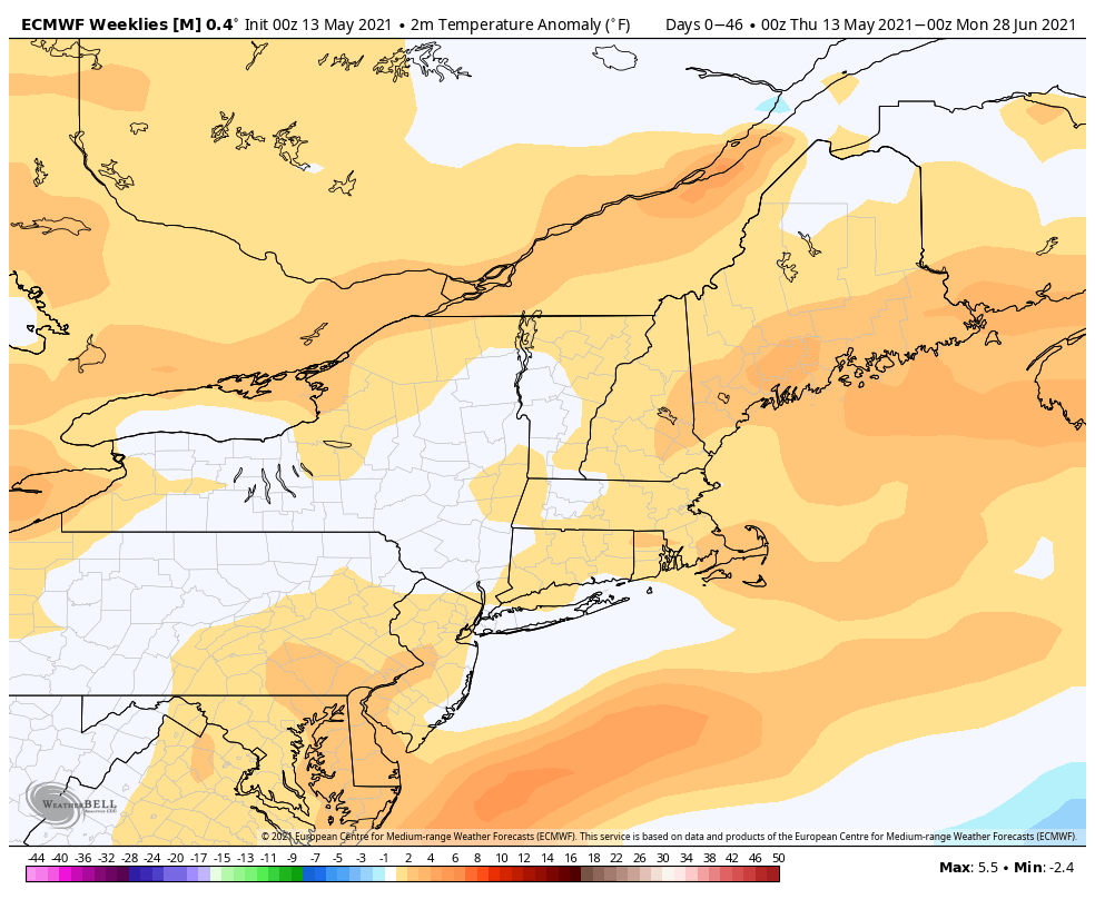
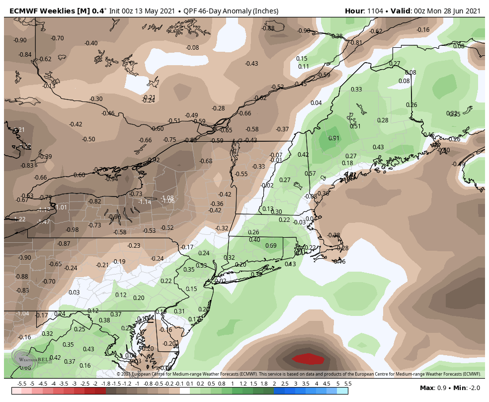
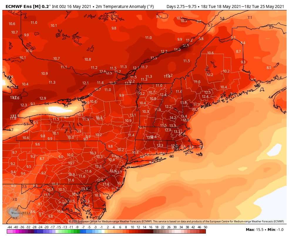
The weather this week will be about 10° warmer than normal on average throughout Southern New England. The long-range outlook through June suggest slightly warmer and wetter than normal weather in Southern New England. That wouldn’t be a bad thing heading into summer.