The first 10 days of June were mostly hot in Southern New England. Cooler weather arrived late in the workweek, and it looks like it will stick around for a few days. The temperature will run below normal through the weekend.

The best chance for rain this weekend is Friday night into early Saturday as another surge of cool air arrives. Temps will struggle to get out of the 60s on Saturday. It will likely reach the low-mid 70s on Sunday as clouds increase in the afternoon. Showers are possible Sunday night and Monday. A few more showers could pop up on Tuesday with seasonable temps returning in the midweek.

It will not be muggy through the middle of next week. Late in the week, the temperature may briefly spike into the mid-upper 80s in the Friday-Saturday time frame.
The overall weather pattern in late-June looks progressive. That means there is unlikely to be a long sustained period of very hot or cool weather. Fronts will pass every few days with a chance of showers/storms, followed by cooler/drier weather. As the next front approaches it will get warmer and more humid.
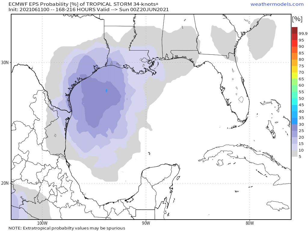
We’re a couple of weeks into hurricane season, and so far it’s been pretty quiet. A tropical storm could form in the western Gulf of Mexico next week. Eventually, it could get caught in the jet stream and pass south of New England. It’s far to early to say if it would come far enough north to bring rain since it has not even developed in the Gulf of Mexico, but it’s the time of year where these disturbances need to be watched.


