Long-Range Forecast – July 7

So far, this summer is going about how we thought it would. The overriding theme of our summer forecast was for a “warm” summer with a lack of extreme heat. To date, the warmest it’s been at TF Green Airport is 90°. It may make it to 90° in the next couple of days, but it will not be much above 90. After that, there is little chance of 90° heat in the next 7-14 days. By comparison, there were 12 days over 92° by July 20 of last year.
The next few days will feature hazy, breezy, and humid weather. There is a t-storm threat, but it’s primarily inland – unless they happen at night, in which case the storms may hang on better near the coast. Showers/storms will likely be scattered, and some places may not see any rain this workweek.
Friday into the weekend looks pleasant, with lower humidity and highs in the low 80s. An approaching front will bring the chance of showers or storms in the mid to late weekend. It’s a little early to give exact timing on the front, but it looks like it will be between Saturday night and Sunday night.
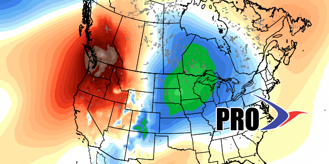
Cool weather will arrive in the Upper Midwest in the next 7 days, and the boundary between the cool weather and warm/humid weather will not be far from Southern New England, and that could mean a few unsettled days early next week. Once again, with summertime rains, it’s tough to talk specifics so far away from the event, but, let’s just say showers are possible Mon-Wed. With cool weather to our west, it looks like we’ll be free from big-time heat through July 20.


