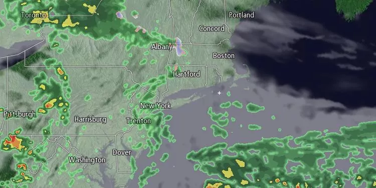
We are into one of those dreary Southeastern New England spring weather patterns. A northeast breeze will keep it unseasonably cool through the middle of the week. We are not expecting as much rain on Wednesday as we saw on Tuesday, but showers cannot be ruled out. The best chance of showers is Wednesday afternoon. Clouds will be stubborn all day. Lows will be in the mid to upper 30s in the morning. Highs will only be near 40 with a 10-20 mph northeast breeze.

Showers are possible Wednesday night. There is a chance that the rain mixes with snow and sleet away from the coast. No snow accumulation is expected in Rhode Island or Southeastern Massachusetts. There will not be much improvement on Thursday. Clouds will stick around, and the temperature will struggle to reach 40. A 10-20 mph northeast breeze will make it feel cooler. A few showers are possible.
The wind direction will change ahead of an approaching cold front on Friday. The day will start with clouds and temperatures in the 30s. There may be some breaks in the clouds, and a southwest wind will get the temperature in the 50s. If we get a few hours of mostly sunny skies, highs inland could reach 60. It’s possible clouds could hang around near the coast most of the day. Rain showers will roll through Friday night, but the weekend looks dry.
Saturday will be partly sunny and breezy. Highs will be in the mid to upper 50s. Sunday looks delightful. Highs will be near 60 inland with mostly sunny skies. An afternoon sea breeze will cool the coast. Highs will reach the 60s inland on Monday. It will stay in the 50s near the coast with an onshore wind.


