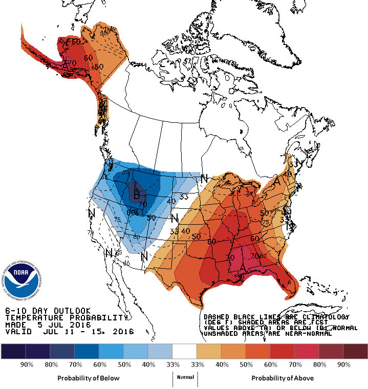
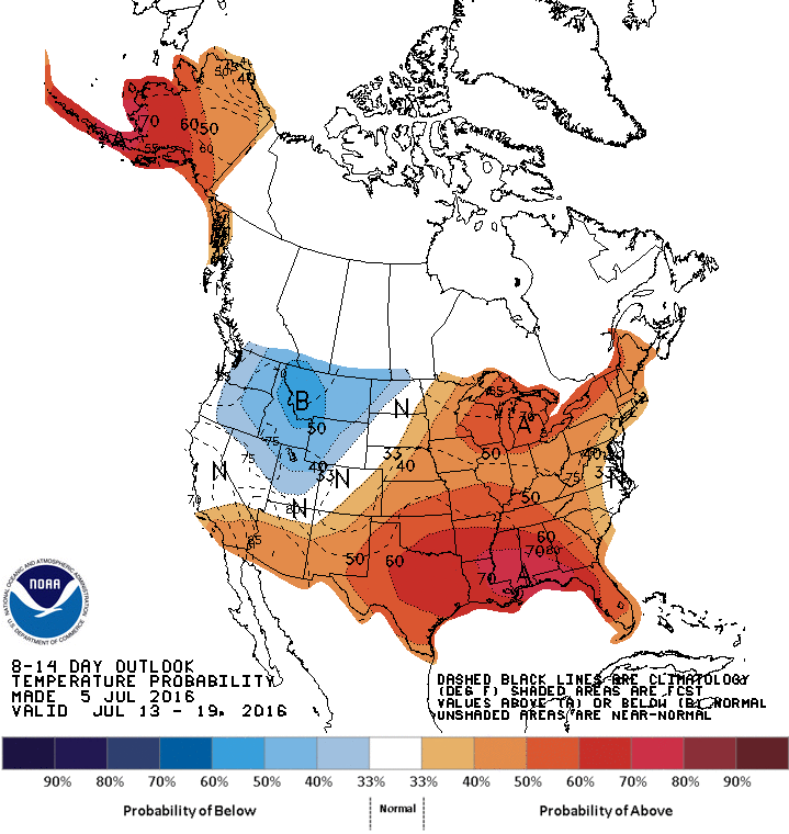
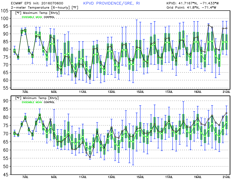
The temperature soared to 90° in the Providence area on Wednesday for the first time since late May. After a June that did not feature any extreme heat, it looks like we’ll have at least a few 90° days this July. The pattern will have some ups and downs, but, overall, should average warmer than normal through the middle of the month.
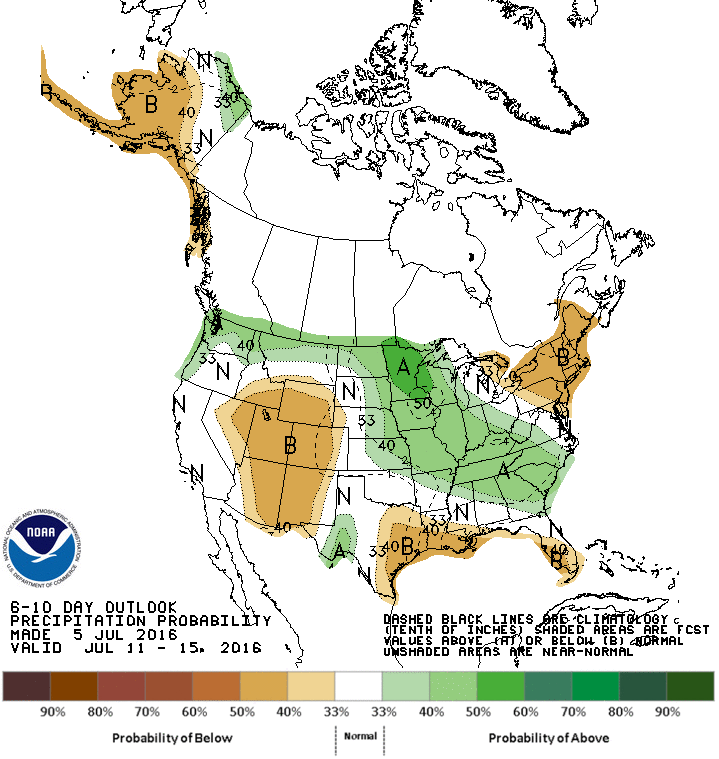
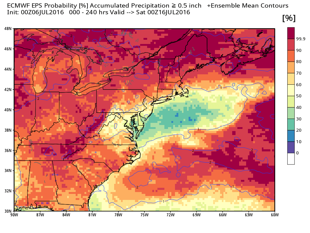
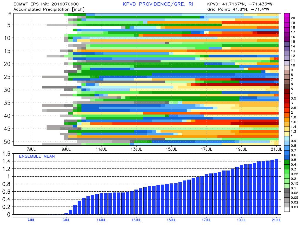
June was very dry with only 29% of the normal rain in the Providence area. So far this month, there have been a few decent downpours, and there has already been 70% of the rain that the Providence area received for the entire month of June. However, the pattern looks relatively dry in the next couple of weeks. Showers are possible Thursday and then again through the weekend, but they will be hit and miss. Summer rain patterns are very fickle. Just look at the storm that brushed by with 0.4″ of rain in Providence Monday night. The same system brought more than 4″ of rain to Nantucket. While it is unlikely that any areas receive 4″ of rain between Thursday and Monday, some places may get 1-2″ of rain, while others receive less than a half-inch.
Nice weather is likely early next week. Humidity should be low early in the week, but it will build as the week progresses. It will also get hot again, with 90°+ possible by mid to late workweek. The general theme through the middle of the month will be for above normal temperatures and below normal precipitation. The hot stretches will be interrupted by cold fronts that could bring showers and t-storms, but likely not widespread rain.