Southern New England will likely have a near-miss with a couple of storm systems early this week. However, a third storm heading our way later in the week may bring snow/mix/rain on Groundhog Day. The weather pattern also favors a return to seasonably cold weather after a relatively mild stretch in the past two weeks.
Monday looks like a quiet day with partly to mostly cloudy skies and a developing northeast breeze. An offshore storm will most likely stay far enough away that the worst we’ll see is snow showers or flurries in Eastern Massachusetts Monday night into early Tuesday. Highs will be in the upper 30s to low 40s Monday.
A second disturbance will drift through on Tuesday. It will keep clouds in the picture, but steady snow is most likely not going to happen. A few flurries are possible, with no accumulation. Highs will be in the 30s. Cold air surges in on Wednesday. Expect bright skies with highs in the low 30s and lows in the teens.
After a cold start, the temperature will moderate into the upper 30s to low 40s on Thursday. A fast-moving storm system may develop along a frontal boundary over the Southeastern United States.
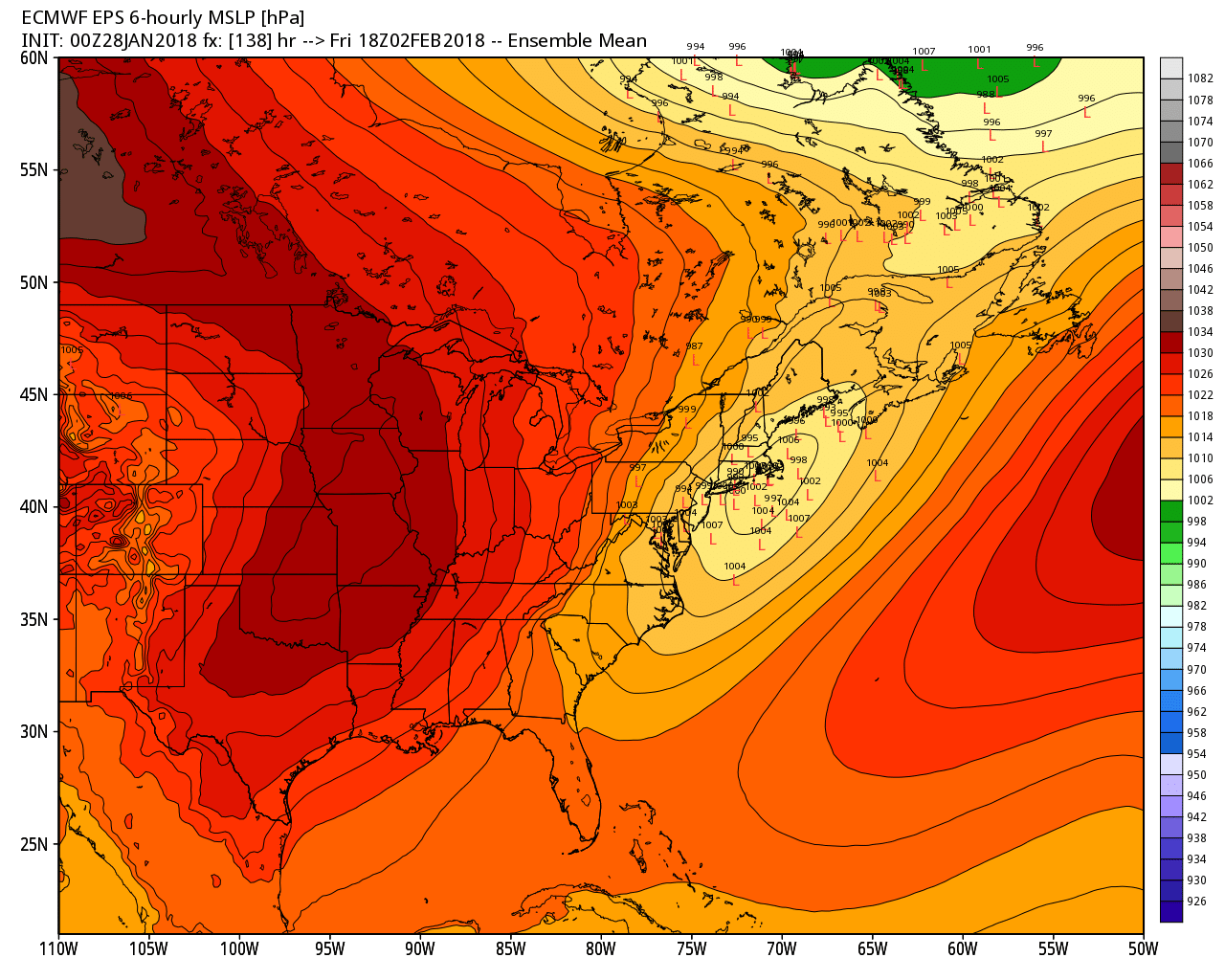
It’s early, but that storm has a decent chance of bringing accumulating snow to at least part of CT, RI, and MA. As you can see from the above graphic, the low pressure center is fairly close to the coast, and even inland on some projections. Mix/rain could be an issue near the coast. I don’t think the storm has blockbuster potential. It’s a fast-mover, so a moderate snow event is possible.
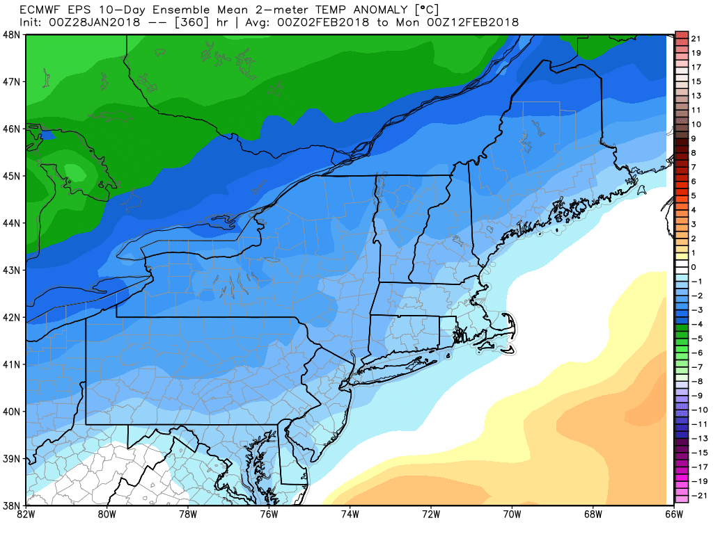
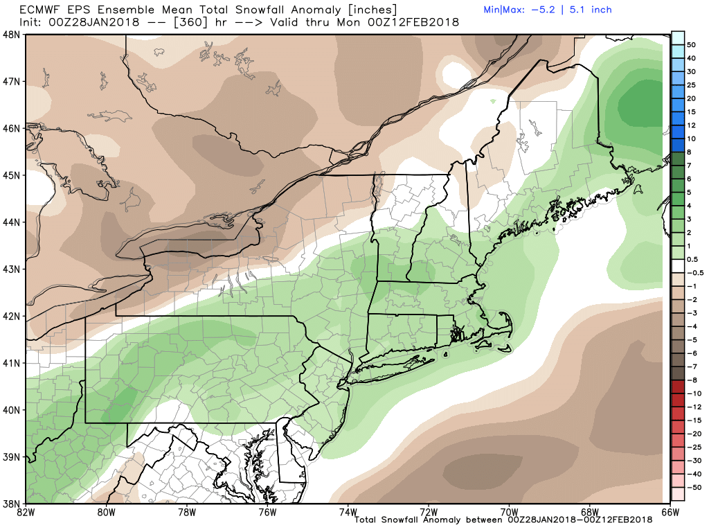
If that storm does not produce snow, there will likely be more chances for accumulating snow as we head through the first half of February. A colder weather pattern develops in the Eastern United States, and the EPS model is projecting above-normal precipitation/snow for the first 10 days of the month.