December 10 – Snow Wednesday AM; Rain Saturday
Cold air is arriving at the same time that another round of precipitation is moving in to Southern New England. Any rain will change to snow from north to south late Tuesday night into early Wednesday. The snow may be steady enough to cause problems with the Wednesday morning commute.

It’s a complex and relatively short-lived system, so there’s not too much of a window for accumulating snow. The best chance of snow accumulation is midnight to 8 am inland and 4 am to 12 pm near the coast. It looks like a 1-3″ event, and some of that snow could melt on pavement cutting into the impact that it has on roadways. Leave extra time for the morning commute if you wake up and see snow sticking to your driveway or street.
The temperature will be in the low to mid 30s in the afternoon before falling below freezing overnight. Watch out for slick spots after dark. Thursday looks dry and cold, with highs in the low 30s. It will get a bit milder on Friday as it stays dry. Expect highs in the mid 40s.
The next weather-maker arrives on Saturday and it looks like an “inside runner”, which means the storm’s center will pass over New England drawing in warmer air and bringing rain. It has the potential to be a soaker with more than 1″ of rain possible. If that’s the case, then the first half of December is going in the books as quite wet in Southern New England. In fact, many areas will have received a full month’s worth of rain in the past two weeks if the Saturday storm delivers on its promise.

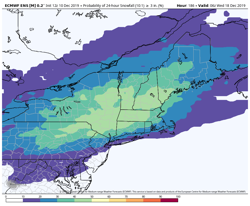
Looking ahead to next week, I’m eyeing Tuesday for some snow potential. A storm system may track far enough south to lock in enough cold air for snow accumulation. It’s early, but the EPS mean model is projecting a 20-50% chance of more than 3″ of snow for a big chunk of Southern New England. That’s a decent signal that it’s worth keeping an eye on this system.


