The workweek ends with very cold weather on Friday. The temperature will go from the teens in the morning to the low 30s in the afternoon under sunny skies. It will get cold again Friday night as the temperature nosedives with clear skies and a light wind. Look for the teens again at dawn on Saturday.

A wind shift brings in milder air Saturday afternoon. The temperature will soar into the 40s and may touch 50 in some towns. Sunday also looks relatively mild. Highs will be in the upper 40s to low 50s with dry skies.
Looking ahead to next week, it stays dry and mild on Monday before another rain event on Tuesday. A break in the action is likely on Wednesday before another storm approaches on Thursday. There is a low chance of snow with that storm, but the early outlook is for yet another mainly or all rain event in a snow-free February. If the storm tracks farther east, it could produce some snow. The Thursday storm is way down the road, but early indications are it could bring a decent amount of precipitation.
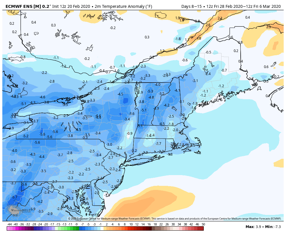
The long-range outlook favors near or colder than normal weather in early March. That figures since we’ve had a very mild winter without much snow, and when March arrives many people start to think about spring. The weather pattern, however, may favor wintry weather in the early part of the month. There’s no guarantee of snow, but colder than normal weather is a good first step towards getting something.