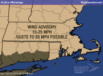
Forget the 40s and 50s that moved through Southern New England over the weekend, winter is far from over, and there will be no doubt about it this week. A cold front will move through Sunday afternoon bringing some chilly weather to the Northeast. It will be breezy to windy and cool in Foxboro for the AFC Championship game. The temperature will fall from the low 30s at game time to the 20s with wind chills in the teens by the time it ends.

By Monday morning, the temperature will have fallen into the teens to low 20s with wind chills ranging from the upper single digits to the low teens. There will be some sunshine early Monday, with clouds gathering during the day. A rather tricky weather scenario will be evolving over the northern Mid-Atlantic and Southern New England. An upper-air disturbance moving through Pennsylvania and New York will spark a small developing storm over the ocean south of Southern New England. This “meso low” will bring a burst of snow to New England by late Monday continuing through Monday night.
There are several factors which make this a tricky forecast. While the setup is there for a moderate snowfall, the computer modeling is having a difficult time handling the specifics of the forecast. Many of the “global” computer models do not have much accumulating snow in Southern New England. The regional “mesoscale” models are forecasting substantially more snow, with the potential for some areas to get about a foot of snow. It is a rather low confidence forecast considering the first flakes are not that far off.
Snow should develop late Monday afternoon or early Monday evening throughout all of Southern New England. It will be plenty cold enough for snow, and it will likely be a dry, fluffy snow instead of the wet, heavier stuff that most of Southeastern New England has seen so far this winter. The temperature will range from the low 20s inland to the upper 20s near the coast. Snow will continue Monday night, becoming steadiest along the Eastern Massachusetts coast.
As the meso-low develops and moves away from the coast, a disturbance hanging behind the storm called a “Norlun trough” will be the focal point for some locally heavy snow totals. It’s quite possible that the trough sets up just east of Southern New England sparing anyone from the 1-2″ per hour snowfall rates it can produce. Right now, and climatologically, if the Norlun trough does have an impact in Southern New England it will likely be in Eastern Massachusetts and the coast of Maine. The North Shore could be the spot in Southern New England that picks up the most snow from this event.


