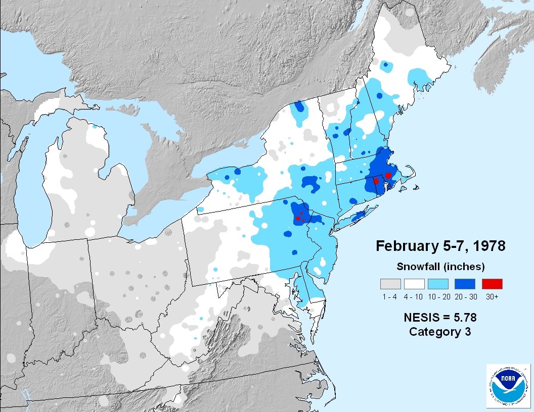
February 6, 1978 – The Big One

Tuesday was National Weatherperson’s Day, today is the anniversary of the Blizzard of 1978, and there is a major storm in the forecast for Friday. It is quite the week for meteorologists in the Northeast! The Blizzard of 1978 is still the benchmark by which all other snowstorms in Southern New England are measured. Some of the highest snow totals were in Northern RI, and parts of the state were crippled for about a week after the storm passed. The storm is famous for coming in fast and furious, a little earlier than anticipated, and forcing massive traffic jams where many people just left their cars on the highway.

Personally, it is one of my first memories of the weather. I was five years old and living in Bristol, RI. I’ll never forget my dad getting me up in the middle of the night to see the snow plow stuck on our street as it tried to deal with the two feet of snow. The next day, the snow lining the driveway was taller than I was! Here are some official totals from the storm, and below is a link to thorough and very interesting recap of the storm from the National Weather Service Boston office.
- Woonsocket, RI – 38.0” (official)
- Rockport, MA – 32.5”
- Providence, RI – 27.6” – 24 hour snow record 27.3” 10AM Mon-Tue
- Boston, MA – 27.1 – 24 hour snow record 23.6” 7 PM Mon-Tue
- Worcester, MA – 20.2”
- Hartford, CT – 16.9”
- Snowfall rates — up to 3 inches per hour
http://www.erh.noaa.gov/box/papers/Bliz78NWS.pdf – NWS recap
http://www.boston.com/news/specials/blizzard_of_78/ – Boston.com recap
http://bit.ly/X3xnAI – Projo recap and photo gallery


