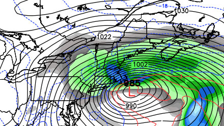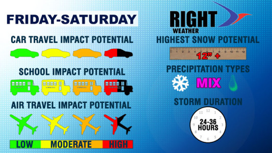
A major winter storm, that could be the largest in years, is likely to have a significant impact in the Northeast Friday into Saturday. The storm is the combination of two weather systems moving across the country from west to east. A storm in the northern branch of the jet stream will transfer energy to a developing storm near the North Carolina coast. The secondary storm will become the major player as it moves southeast of Southern New England Friday night into Saturday. Winter Storm Watches are in effect for most of Southern New England. In our opinion, there is a good chance Blizzard Warnings will be issued unless the forecast changes drastically.
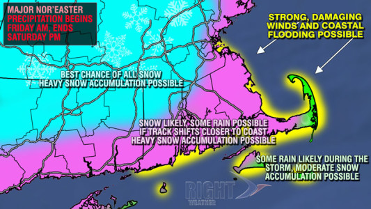
Snow will develop late Thursday night or early Friday morning in Southern New England. During the first 12 hours of the storm, some mixing with, or changing to, rain is possible from the coast to the I-95 corridor. As the storm intensifies, the wind will shift to the northeast and bring in colder air, changing the precipitation to snow for most of Southern New England Friday evening.

The snow will be wind-whipped and heavy at times Friday night into Saturday morning. Blizzard or whiteout conditions are possible late Friday night into Saturday morning. Strong, damaging winds may occur near the coast and, especially, on Cape Cod and the islands where hurricane force gusts are possible. Some of the latest information suggests that the storm may linger on Saturday, with accumulating snow continuing through the midday hours.

Coincidentally, today is the 35th anniversary of the start of the all-time great snowstorm for much of Southeastern New England. By early on the morning of February 7, 1978, much of the area was buried under more than two feet of snow.


