A south to southeast wind in early-March does not guarantee nice weather in Southern New England. The ocean temperature is in the upper 30s to low 40s, and that wind direction can lead to cool, cloudy weather. Clouds are stubborn on Monday with a south-southeasterly breeze. Late-morning temperatures were near 40 in spite of the cloud cover, but will not make it to 50 without some afternoon sunshine.

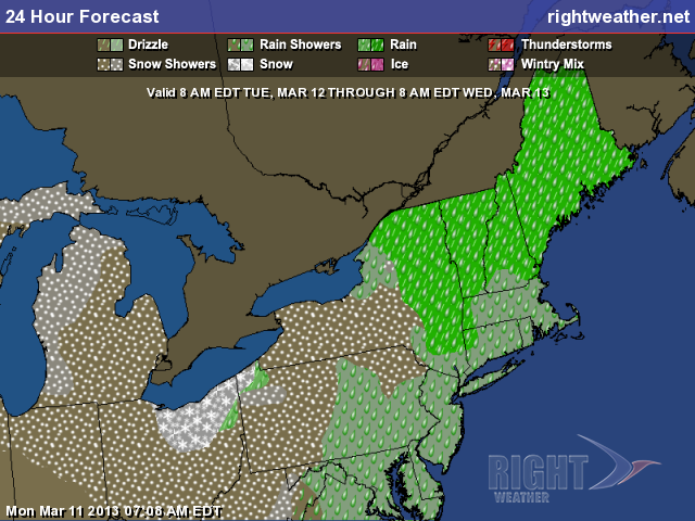
Monday night will not be cold, with the temperature staying near 40 under cloudy skies. There may be some mist, drizzle and fog. An approaching cold front will deliver showers Tuesday afternoon and evening. There will be little, if any, sunshine before the rain arrives, but it will be mild with highs in the upper 40s to low 50s. The rain should become steadiest late in the day and may slow the evening commute a bit. It will end by midnight or shortly thereafter. The National Weather Service has issued a Flood Watch for part of Massachusetts as the combination of snowmelt and the rain could lead to minor river/stream flooding.
Nice Wednesday, cooler late-week

Wednesday could be the nicest day of the week. A drier westerly wind will develop behind the departing cold front. The cool air will lag behind the front, and highs should reach 50 in many spots by midday Wednesday. It will be partly to mostly sunny. A gradual cooling trend with dry weather is in the forecast for the late-workweek. Thursday will be partly cloudy with highs in the 40s. Friday looks chilly for mid-March, with highs in the upper 30s to low 40s under partly cloudy skies.
Mid-weekend rain showers possible
Looking ahead to the St. Patrick’s Day weekend, there will be a mid-weekend Alberta Clipper that threatens Southern New England with some rain showers Saturday and/or Saturday night. Right now, it does not look like a washout, and the weather may be ok for the St. Patrick’s Day parade in Newport Saturday morning. Sunday looks like the cooler of the two weekend days.


