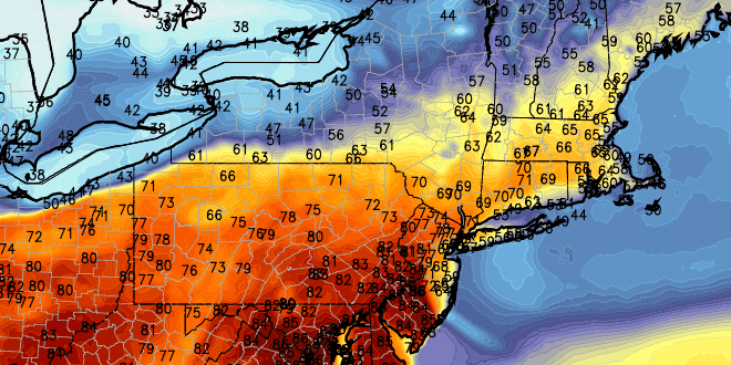
Tuesday was the warmest day in more than six months in Southern New England. The high temperature hit 77° at TF Green Airport – the warmest since October 6, 2012. It was also well into the 70s near the coast because of a westerly wind. A different wind direction means a slightly different day in Southern New England on Wednesday. Inland locations should be warmer than normal, although not quite as warm as Tuesday. It will be considerably cooler near the coast with an onshore breeze.
The day may start out similar to Tuesday with some showers and t-storms passing through Southern New England. It will be a partly to mostly cloudy day, with highs in the mid 60s inland, and in the upper 50s near the coast. The onshore breeze that develops will actually knock the temperature back a few degrees in the afternoon.

The weather will become unsettled and much cooler for the end of the workweek. Rain showers are possible Wednesday night as the wind swings around to the northeast. The breeze, combined with clouds and a few showers could keep temperatures in the 40s on Thursday. The late-week and weekend forecast has not changed much at all. Rain is likely on Friday. Highs will be in the 40s to low 50s. There could be some heavy downpours, with the potential for about an inch of rain in most of Southern New England.
The storm should depart by Saturday morning, leaving some decent weather in its wake for the weekend. High temperatures will be seasonable, in the 50s, on Saturday and Sunday. One thing we’ll keep an eye on is how long the low clouds may hang around on Saturday morning before breaking into sunshine. Some computer models are hinting that there could be some low clouds, but, with a westerly wind this time of the year the sun should be able to burn through the clouds. Sunday looks mostly sunny, with highs in the low to mid 50s.


