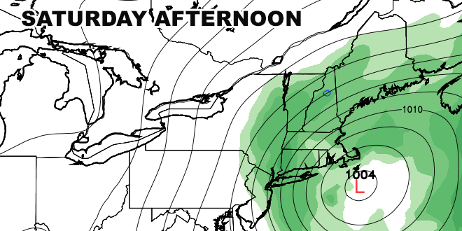
The same storm system that brought the violent tornadoes to the Midwest earlier this week will move into the Northeast as expected late Thursday through Friday. Showers are still in the forecast from late Thursday through Friday. The new twist on the forecast is that the front is unlikely to depart prior to the Memorial Day weekend. A storm will develop Friday along the front near New York City and pass very slowly just south of Southern New England from Friday night into Sunday. As a result, the first two days of the weekend in New England will feature drastically different weather than what was previously forecasted.
Friday looks rainy with highs in the low 60s. By Saturday, as the storm continues developing south of Long Island, the wind will swing around to the northeast. Cooler air will funnel into New England, and the high will be in the 50s with occasional rain. Depending on the exact track of the storm, it may be even chillier on Sunday. In a worst-case scenario, it is possible the temperature will be in the 40s to low 50s during the day on Sunday if the storm moves east of Cape Cod. Occasional showers will continue through most of the day before the storm finally moves away late in the afternoon. The storm may even bring some snow to the highest elevations of Northern New England – highly unusual for Memorial Day weekend!
The only bit of good news is that Monday still looks like a decent day. There should be increasing sunshine with highs in the 60s.


