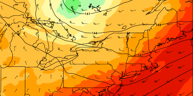
Friday was the second consecutive 90° day away from the coast in Southern New England. Saturday may make it three in a row at 90° or higher, and that would be enough for the first heat wave of 2013, and the first in the Providence area since July 16-18, 2012. The three-day average high temperature during that stretch was close to 95°. This time around, it’s likely to be close to 91°. If you’re looking for relief without air conditioning, you have two choices – head to the beach or wait until late-Sunday into next week.
Friday night will be warm and muggy, with mainly clear skies and lows in the low to mid 60s near the coast, and mid to upper 60s inland. Some patchy fog is possible near the coast. Any fog should burn off quickly on Saturday, and the temperature will quickly jump through the 70s into the 80s by mid-morning. Once again, there will be a southwesterly breeze, and that will keep the temperature near 80° at the coast during the afternoon. It should reach the upper 80s to low 90s inland. It’s hard to believe it was just a week ago that the temperature was in the 40s during the Memorial Day weekend!
There will not be much relief from the warm weather and high humidity Saturday night. The low temperature will be similar to Friday night with partly cloudy skies and patchy fog possible near the coast. A slight shift in the wind direction, along with a stronger breeze and a few more clouds, will help to cool Southern New England a bit on Sunday. Highs inland will be in the low to mid 80s, and it will be in the 70s near the coast. The wind may reach 20-30 mph near the coast by late in the afternoon. Some low clouds and fog could roll in off the chilly ocean. Overall, it looks like the weather will be deteriorating Sunday afternoon – especially near the coast, although, rain is not expected until Sunday night.

Showers and thunderstorms will move into the Northeast by late-Sunday, and rain is possible from late-Sunday evening into Monday morning. The front that is pushing the showers and storms east will slowly move through New England on Monday, resulting in lingering wet weather and temperatures in the low 70s. Once the front gets offshore, drier and pleasant weather will move into New England for the remainder of the workweek. Highs will be in the 70s, and lows will be in the 50s – just about normal for early-June.
We’ll be keeping an eye on the tropics next week. A tropical system may form in the Gulf of Mexico by late in the week. Don’t forget the Summer Outlook and Atlantic Hurricane Outlook will be released to Right Weather Pro members on Saturday, June 1. Sign up today, it’s just $39.99 for a year of access.


