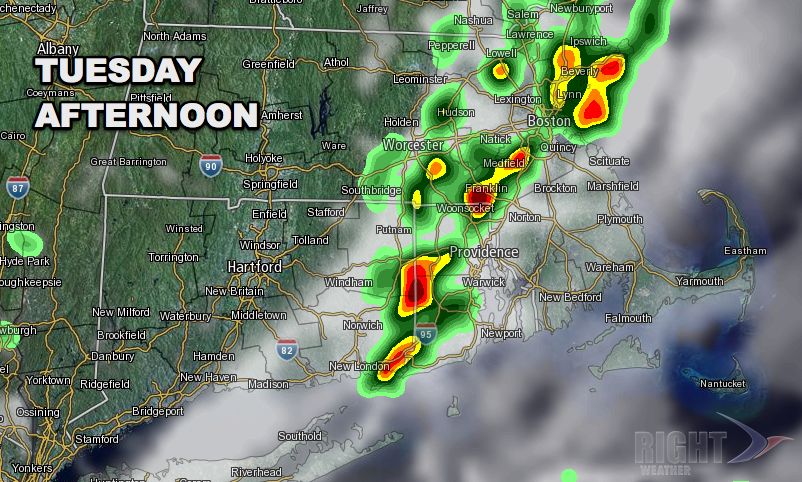
Sunshine broke through the clouds in most of Southern New England Tuesday morning. The early to midday sunshine will help to give fuel for thunderstorms which may develop along a cold front that will pass through Southern New England during the afternoon.
Some sun in most of SNE. Strong t-storms over Long Island may impact SNE coast later this AM. http://t.co/2NJyL4XLQv pic.twitter.com/V0WNt5m9n6
— Right Weather (@RightWeather) September 3, 2013
As of mid-morning, there were strong thunderstorms over Long Island that were moving east-northeast – possibly threatening the SNE coast by late in the morning.

A warm, muggy, moisture-laden atmosphere combined with energy from the cold front are the ingredients in place for potentially strong thunderstorms. The best chance of thunderstorms in E CT, RI and SE MA is from late in the morning until early in the evening from west to east. Threats from the thunderstorms include frequent lightning, torrential downpours, hail and gusty wind. The thunderstorms may not be widespread, and it’s possible that the conditions will not come together just right for any strong storms to develop. It will be a warm and humid day with highs in the mid 70s at the coast and low 80s inland.
Drier weather will move in behind the front Tuesday night, and it looks quite nice on Wednesday.


