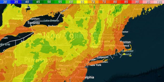
The unseasonably warm start to October in Southern New England continues on Wednesday. The day will begin with mostly clear skies and low temperatures in the mid to upper 50s. The afternoon will be mostly sunny, breezy, and warm. Highs will reach the mid to upper 70s in most spots, and some inland locations should be between 80-85°.
It will stay relatively warm on Thursday. It looks like another mostly sunny day, with highs inland in the mid to upper 70s, and highs near the coast in the low 70s as the breeze turns onshore in the afternoon. Low temperatures Wednesday and Thursday night will be in the mid to upper 50s – about 10° warmer than normal for early October.
Clouds will slowly increase on Friday. Highs will be near 70° at the coast, and in the low to mid 70s inland. Showers are possible from late Friday afternoon until around dawn on Saturday. It will stay mild Friday night.
The first weekend of October looks dry and a bit warmer than normal. There is the chance of a few showers early Saturday, with skies becoming partly sunny in the afternoon. Highs will be in the upper 60s to low 70s. Sunday should be warmer inland and breezy near the coast. It will be partly to mostly sunny with highs in the mid to upper 70s inland, and low 70s near the coast.

A cold front combined with some tropical moisture from the Gulf of Mexico will lead to the chance of rain in Southern New England early next week. The front will move through Monday, but there are still questions about how much moisture will stream north out of the system in the Gulf of Mexico. Right now, the scenarios on the table include everything from a mainly dry frontal passage to soaking rain if a tropical storm gets caught by the front and brought north. In any event, the outlook for most of next week is for more warmer than normal weather.


