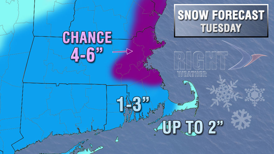
A fast-developing storm will bring light to moderate to snow to Southern New England on Tuesday. The storm will move through fairly quickly, but it may have an impact on the afternoon and evening commute.

After a frigid and clear start, clouds thickened Tuesday morning, and snow will develop from west to east through Southern New England by mid to late morning. Snow should reach RI between 10am-11am, and will it will develop in SE MA between 11am-12pm. The snow should continue through most of the afternoon before winding down early in the evening. The precipitation may change to light rain or freezing rain before ending. While the snow does not look terribly heavy, it will likely accumulate because the surface temperature will range from the upper teens to low 20s at the start, to mid to upper 20s by sunset. The temperature will continue to rise near the coast into the low 30s during the evening.

We are expecting a general 1-3″ snowfall for Southern New England, with a bit less on lower Cape Cod and the islands, and a bit more possible in part of Eastern Massachusetts where the precipitation may be enhanced and/or last a bit longer. The National Weather Service has issued a Winter Weather Advisory for most of Southern New England. It will become partly cloudy Tuesday night, and the temperature will fall into the upper teens to mid 20s by dawn Wednesday.
The weather looks quiet Wednesday through Friday, with a gradual warming trend. Highs will be in the 40s on Friday. Looking ahead to the weekend, rain showers are possible Saturday and Sunday, with the better chance of steady rain on Sunday. It will, however, be mild with highs in the 40s and 50s.


