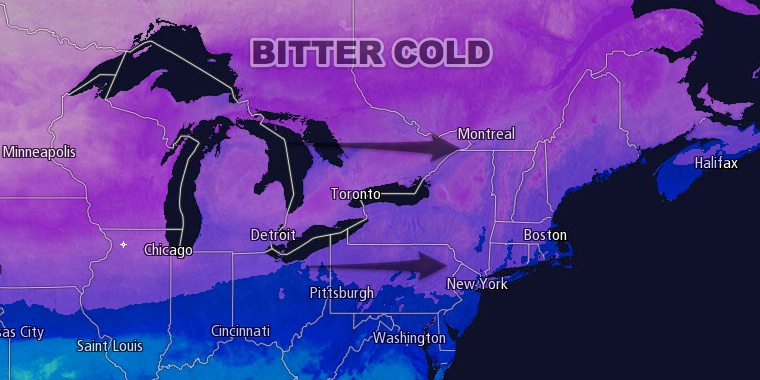
The high temperature for Tuesday will go in the books in the mid to upper 20s in Southeastern New England, but that is not how anyone will remember it. It was warmest just after midnight, and after falling into the single digits to low teens by dawn, the temperature rose only into the mid teens during the afternoon – even with abundant sunshine. The wind howled all day, and wind chills values were near or below zero.
- National Weather Service confirms a blizzard in Eastern MA
- Unofficial snow totals January 2-3, 2014
- Sign up for Detailed Storm Reports from Right Weather
It will be clear and frigid Tuesday night. Lows will be in the single digits to low teens, and the wind chill will be 0 to -15. Wednesday also looks very cold, with sunshine and highs in the low 20s. Once again, there will be a breeze that makes it feel about 10-15° colder than the air temperature.

Wednesday night into Thursday will not be as frigid, but will still be colder than normal. Lows will be in the teens Thursday morning, and highs will be in the upper 20s to low 30s Thursday afternoon with partly cloudy skies.
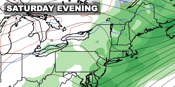
Warmer weather is ahead from Friday through the weekend, but there will be a price to pay with showers possible near the coast on Friday, and rain likely Saturday into Saturday night. Friday will be mostly cloudy with the chance of a few light showers. Highs will be close to 40. Saturday will also be cloudy, but milder, with highs near 50. Rain will likely develop Saturday afternoon, and it may be heavy at times Saturday night. The early outlook for the Patriots vs. Colts is for rain and temperatures in the upper 40s. In a worst-case scenario, the rain will be as steady as it was for the last game against the Buffalo Bills. It looks about 10° warmer than it was for that game.
Showers may linger early Sunday before giving way to mostly cloudy skies and highs in the 40s. Another storm streaming out of the Southeastern United States may make a run at Southern New England bringing more rain early next week.


