A few things I will be monitoring on Saturday:
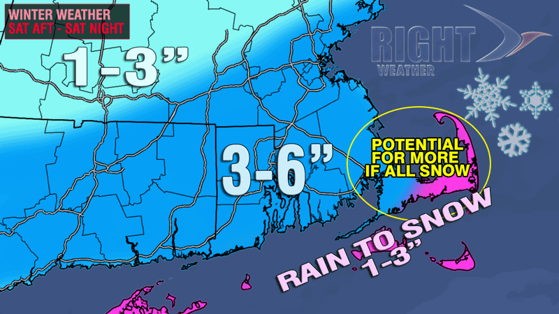
- The temperature near the coast before the precipitation arrives. Some of the models get it to near 40 degrees, and, if that’s the case, then there will probably be some rain or mixed precip. – at least at the start of the storm.
- The wind direction near the coast. If it is east or east-northeast that may help to draw in some milder air. A northeast wind will help to filter in colder air.
- How much dry air the storm runs into in CT and NY
One more thing, after this storm, the big weather story will be the potential for the temperature to drop to near 0 by Friday morning in one of the biggest Arctic outbreaks that we’ve seen in a while. Last winter’s coldest temperature at TF Green was 9°, it should be colder than that either Friday morning or Saturday morning.
It’s time to get some rest and get after it tomorrow. The Live Blog will be up and running for Right Weather Pro members. At $39.99/year it’s a bargain. That’s about a dime a day.


