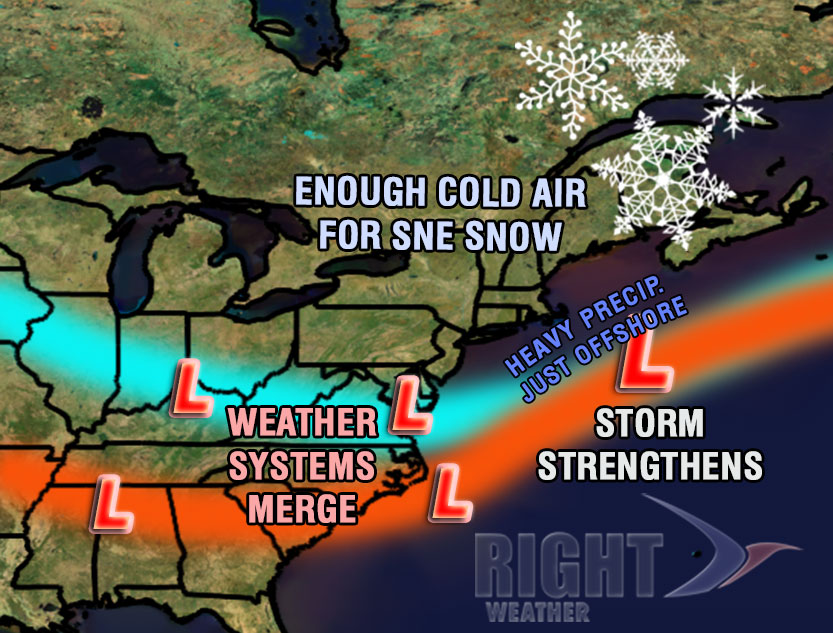
Late Saturday night: The snow will wind down from west to east, most likely ending by dawn in RI. The best chance of seeing snow early Sunday is on Cape Cod and along the east coast of MA. This is the timeframe where the E MA coast and Cape Cod could pick up several inches of snow – IF it is all snow that falls after midnight. The precipitation type is very uncertain in those areas. The wind will be very gusty on Cape Cod as the center of low pressure passes to the southeast. The temperature will fall into the 20s.
Sunday: After a few lingering flurries in RI and interior SE MA, skies should become partly sunny, but it will be cold and windy, with temperatures struggling to get above freezing, and a 15-30 mph NW wind, with some higher gusts. The wind chill will be in the teens to low 20s all day. Snow may persist for a few showers into the mid-morning on the E MA coast and Cape Cod. The same clearing trend will takeover in the afternoon.


