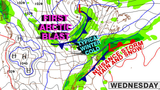
The temperature will be in the low 30s, and it has been unseasonably mild lately, so there is also no guarantee that the snow will stick on contact. It is a tricky forecast, and we’ll continue to stay on top of it. Here is a roundup of some TV station forecasts from the Monday evening broadcasts.

First cold blast arrives Friday
As the storm moves away from the United States Wednesday night, a cold front will move through the Great Lakes and head for the Northeast. At the same time, another storm may form in the Southeast. It will be a close call, but the two systems may be just far enough apart that there will not be any interaction until after they pass Southern New England.
If that’s the case, you can expect a cold front to move through early Friday, and a dry, bitter blast to move in for Friday afternoon and night. If there is some interaction between those two systems, the bitter cold air could be preceded by some snow.
The first cold blast will be short-lived, and the temperature should moderate into the 30s by Saturday afternoon. At that point, another cold front will already be taking aim on New England, and it is timed to move through some time Sunday or Sunday night. The timing is critical and could make a 20° difference in the temperature for the AFC Championship game at Gillette Stadium Sunday evening. If the front holds off, the temperature may be in the 30s. If it moves through early Sunday, the temperature may be in the teens, with single digit wind chills.


