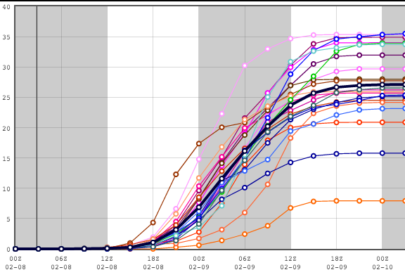
21Z SREF – Short Range Ensemble Forecast
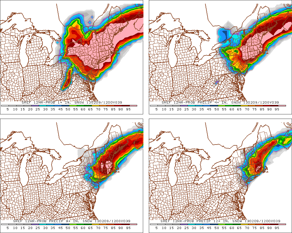
This is a probability graphic showing the odds of certain thresholds of snow totals being reached. That’s the first time I’ve seen a 95%+ chance of 1 foot of snow in NW RI, NE CT, and interior SE MA. That is very impressive!