
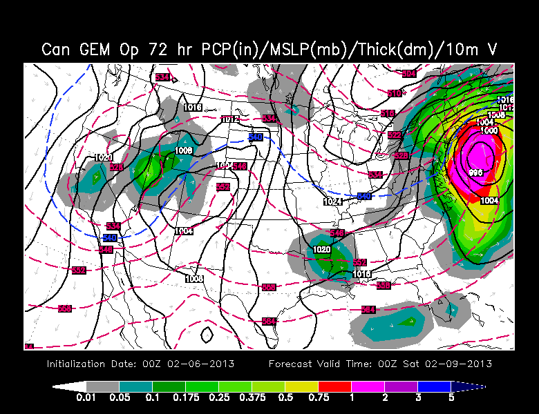
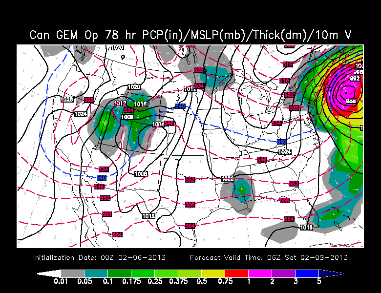
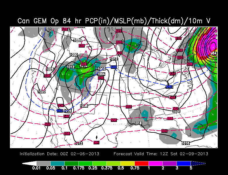
Canadian (GEM)
The 00Z run of the Canadian model is stronger and closer to the coast than the 12Z run. It’s a knock ’em out of the park Major League Nor’easter for Southern New England. Total QPF is around 2″, and it does not look like much rain would be involved for all except the immediate coast, Cape Cod, and the islands. Even there it’s a close call. It also lasts a few hours longer, with accumulating snow until mid-morning. There is not as much extra data to dissect from the Canadian model compared to the US models. Here are a few images showing the track.
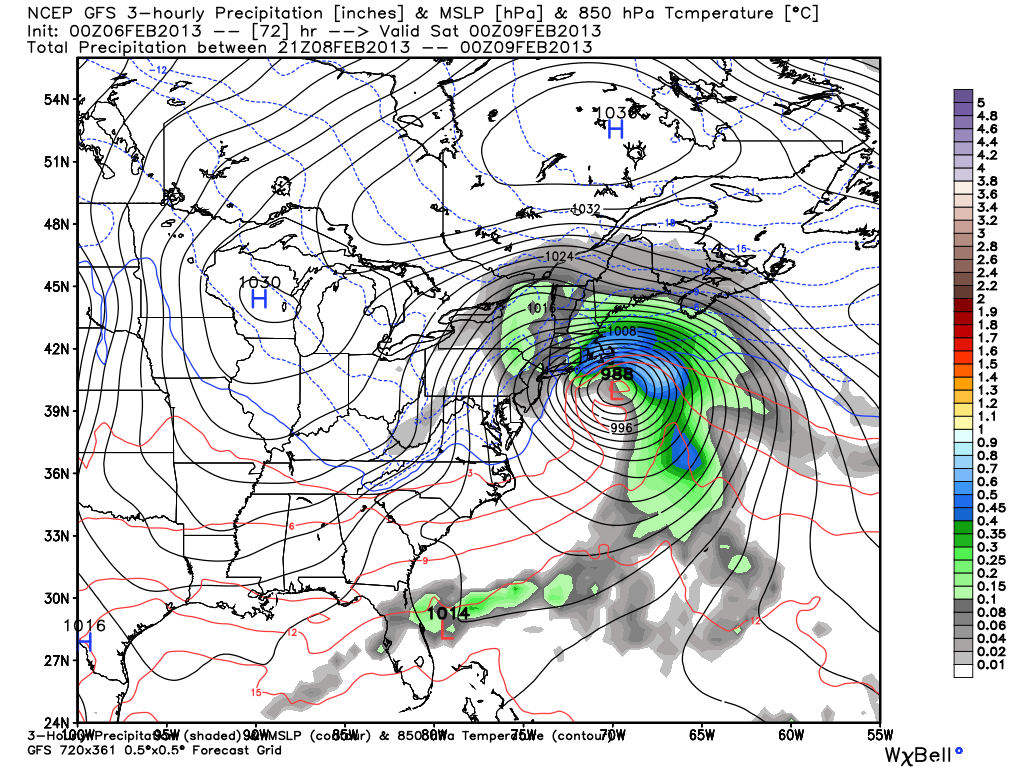
Global Forecast System (GFS)
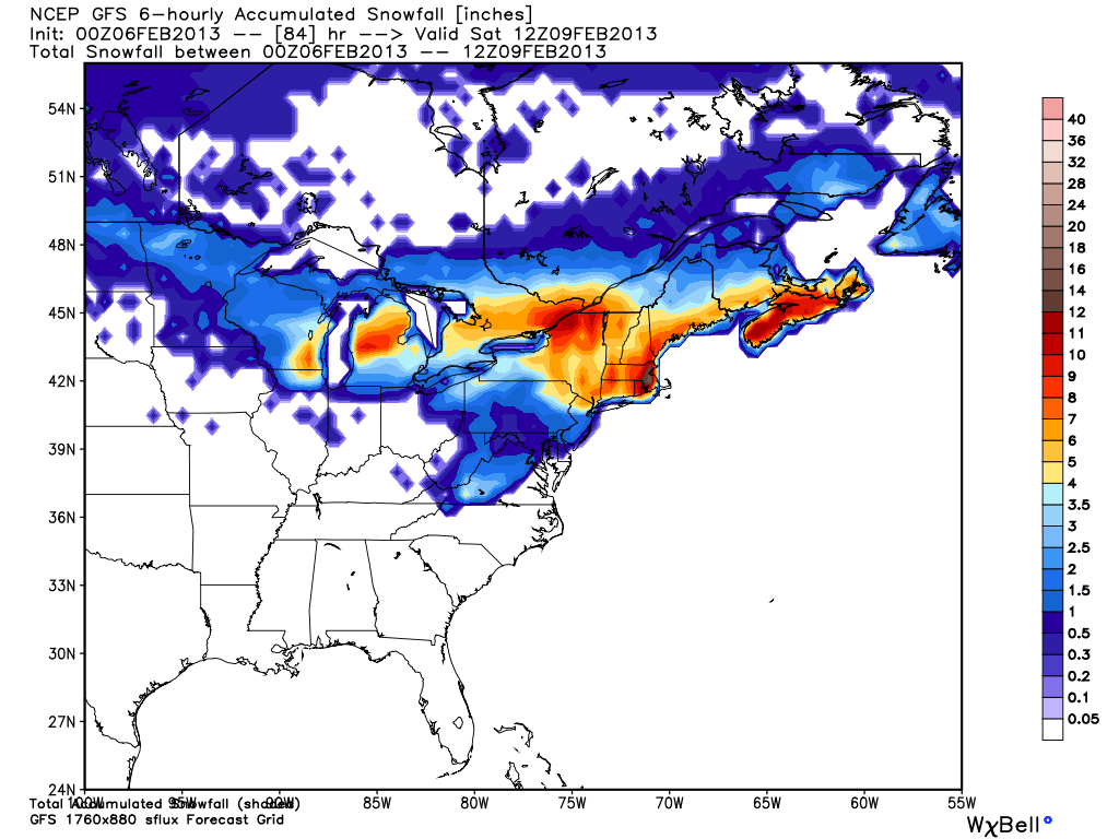
It took a while for the GFS to come around, but the 00Z run picked up right where the 12Z left off with a raging storm south of Long Island by midday Friday. The storm is even more intense than the 12Z run, and it’s also a bit farther north – bringing some precipitation-type issues to Southern New England. The model has a beast just southeast of Nantucket at 72 hours (7 pm Friday). It ends the snow just after dawn on Saturday.
Total QPF is 1-2″ (1.5″ on the nose for Providence area), but the chance for mixing from the coast to I-95 is right at the height of the storm. Snow totals (see graphic below) are generally 8-16″ in Southern New England. You can ignore the Cape/Islands on that map because of grid point issues with the model. Note: When using the BUFKIT tool there is a six hour period of rain or mixed precipitation in the Providence area. That keeps the totals down considerably, with a final amount near 8″.
The 00Z run shows the potential for 65 mph sustained winds on Nantucket. Gusts would be over hurricane force for the Cape and Islands.
It should be noted that the models bring single-digit Arctic air into Southern New England following the storm, with it arriving by Sunday morning.
North American Model (NAM)
The last remaining holdout on the significant storm front was the NAM model. It still was not phasing the northern and southern systems as they hit the East Coast. The Tuesday evening (00z) run changed significantly, but not to the degree that the Tuesday morning (12z) GFS, European, and Canadian were showing. There is a storm that intensifies near Cape Hatteras and moves northeast, but it is not as close to the coast as it is in the other model projections.
The storm gets underway by mid-morning, and the peak of it is in the mid to late evening. It is over by dawn Saturday. The NAM has a precipitation type issue from the coast to Providence around midday Friday. A little surge of milder air arrives just before the storm intensifies. This would lead to a brief period of rain and knock a few inches off the snow accumulation potential. The wind is gusty in Eastern MA, but nowhere near as strong as the other models with closer, more intense storms are projecting. Peak winds in SE MA would be 35-50 mph. Continues on next page with graphics…


