Friday afternoon will be delightful with highs well into the 40s. The snowpack over Southern New England will continue to melt on such a fine day, but it will be replenished this weekend as a large, developing storm sideswipes New England as it moves north from in the Atlantic Ocean.
Cold front with snow Friday night
Clouds will increase Friday evening as a strong cold front approaches Southern New England. Some light snow is likely late Friday night and Saturday morning as the front moves through and the wind shifts to the north-northwest. Energy in the jet stream will invigorate the front off the Carolina coast and a large storm will likely develop quickly during the day Sunday. The most intense part of that storm will likely stay far enough offshore that Eastern New England does not get the full brunt of it, but, even so, there is still the potential for another plowable snow storm with gusty north-northeast winds.

The snow this weekend will likely occur in two separate events with just a few hours between them. The first is the snow produced after the cold front passes late Friday night. Snow should develop by dawn, and the best chance of seeing 1-3″ is inland, with NW RI, CT, and interior MA seeing the steadiest snow. That round of snow will taper to snow showers or lighter snow during the day Saturday, while the storm gets organized over the Atlantic Ocean.
Second storm could have bigger impact
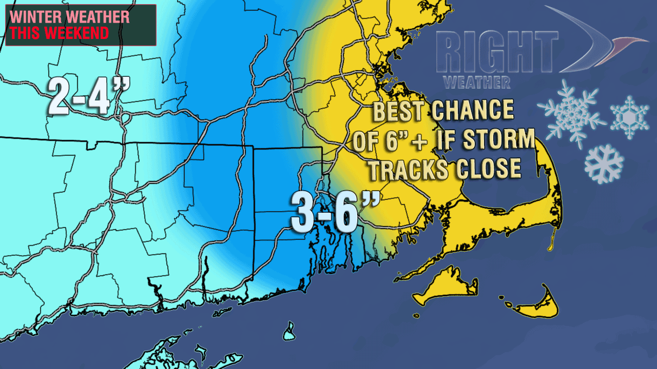
As the storm moves north Saturday night, snow should overspread Eastern New England including E CT, all of RI, and MA east of the Berkshires. The highest likelihood of significant accumulating snow and the strongest wind is in E MA. Right now, it looks like the storm will bring 2-6″ of snow as it passes east of Cape Cod late Saturday night through midday Sunday. The lower amounts are likely to occur in E CT and SW RI, with the highest amounts in SE MA. There is the potential for more snow if the storm tracks closer than some computer models are projecting. It will be an intense storm, and the snow will be driven by 20-40 mph winds, with the strongest gusts on Cape Cod and the islands. Snow forecast map on next page.


