Snow Totals
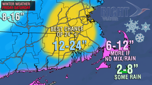
The map has not changed considerably. The likelihood of 12″ of snow in most of Southern New England is very high, and the map reflects that. The area shaded in yellow is the part of Southern New England with the best chance of seeing the jackpot from this storm. There will likely be some 2-3″ per hour snow bands that set up in SNE Friday night, and thunder/lightning is also possible. It’s difficult to know exactly where that will occur, but the yellow shaded areas stand the best chance of seeing it. Only three storms since 1905 have ever topped 20″ in Providence. There is a reasonable chance that this storm becomes the fourth one.

Storm Impacts
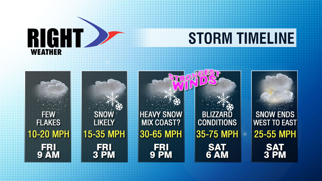
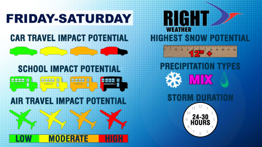
Travel of all types will be severely impacted and is not recommended. The storm should be fierce enough to temporarily shut down TF Green and Logan Airport, and possibly other Northeast airports, too. Car travel will be treacherous Friday evening through, at least, Saturday morning. The plow trucks will not be able to keep up with the wind-driven snow rates, and venturing outside Friday night could be a mistake. Given the timing of the storm, it’s possible that school will be in session on Friday, although some districts may decide to play it safe. 2-4″ of snow is possible by 2-3 pm Friday. It will be snowing at that time, and the wind will be increasing.

This is a long-duration storm that lingers through most of Saturday. Even if the snow stops, it will take some time to dig out and get the roads cleared. we expect this storm to have impacts that last into Sunday, and possibly next week.


