The cool, dry start to March will likely be interrupted by a long-duration Nor’easter that will bring a myriad of weather hazards to Southern New England. Most reliable computer models have shifted to a scenario where the storm has a moderate to major impact in the Northeastern United States. While there is still time for the forecast to change and the storm to have less of an impact in Southern New England, the situation warrants highlighting many of the potential impacts from a more direct hit.
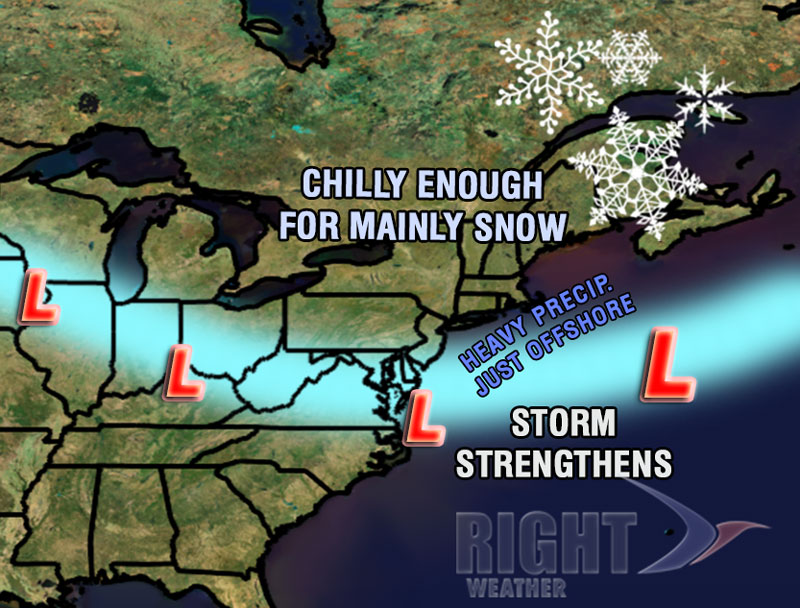
The storm will move through the Midwest into the Mid-Atlantic on Tuesday spreading moderate to heavy snow from Chicago to near Washington DC by late Tuesday night. The weather in Southern New England will be quiet on Tuesday, with partly sunny skies and highs in the low to mid 40s. Some light rain/snow is possible by late Tuesday night into early Wednesday as the storm moves into the Atlantic Ocean east of Virginia. The exact track the storm takes once it hits the Atlantic Ocean is still in question, but there should at least be fringe effects from the storm in Southern New England. The two scenarios at either end fo the spectrum are outlined below.
[twocol_one]
Track out to sea
- Better chance of all snow, but a much lower chance of heavy precipitation
- Gusty wind near the coast, not strong enough for much damage
- Consistent battering of the shore due to large waves, minor beach erosion
- Minimal power outages likely

Track close to Southern New England
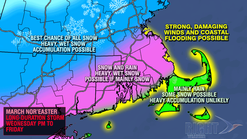
- Long-duration moderate to heavy precipitation likely. Some rain near the coast. Heavy, wet snow inland.
- Gusty wind everywhere. Strong, damaging winds near the coast for 1-2 days.
- Significant beach erosion due to rough surf and minor storm surge for several high tide cycles.
- Concern for power outages due to combination of heavy, wet snow and strong winds
The latest computer model guidance suggests a track closer to Southern New England, bringing the potential for heavy, wet snow, strong winds, and coastal flooding. It’s a bit too early to get specific on the snowfall amounts, but the hardest hit areas would likely see more than 6″ of snow based on the current consensus track.


