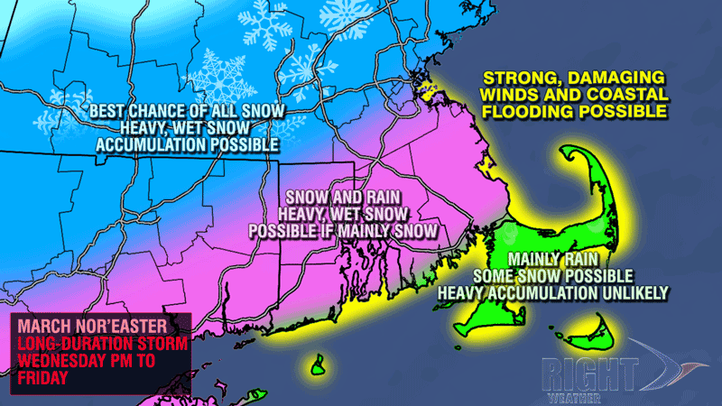

At this time of the year, snow has a difficult time piling up during the day unless it is really coming down. If the storm track is far enough away that the heaviest precipitation stays out to sea, then the odds of a significant snowfall are lower because the snow will not accumulate as much during the day due to the higher sun angle.
It is hard to say exactly when the brunt of the storm will be, but some precipitation can be expected from late-Wednesday into, and possibly through, the day on Friday. Right now, it looks like the steadiest precipitation will be from late Wednesday night into Thursday night.


