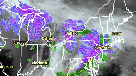
The calendar will soon say spring, but the weather forecast for Southern New England is screaming winter for the foreseeable future. Snow and sleet is in the forecast for Southern New England Monday night. The precipitation will change to sleet and/or rain in most of Southeastern New England by dawn Tuesday. The high temperature on Monday was only in the low to mid 30s after a morning low in the teens to low 20s. The ground is rather cold for mid-March, and with the heaviest burst of frozen precipitation expected in the dark of night there will likely be some snow accumulation before the changeover takes place.
- TV Station snow forecast roundup
- National Weather Service issues Winter Storm Warning and Winter Weather Advisory
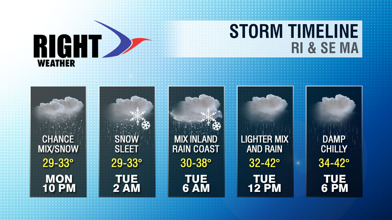
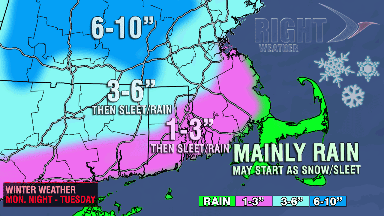
The x-factor with the snow accumulation is how quickly the precipitation changes from snow to sleet as some milder air works into the system Monday night. There will be a thin layer of air between 5,000-7,500 ft. off the ground that will get to about 1-3° above freezing. That is not too warm, but it’s warm enough to melt snowflakes into raindrops that will refreeze before reaching the ground. The resulting precipitation will be ice pellets (sleet). If this milder air arrives ahead of schedule, then the snow accumulation will be limited to about an inch from the coast to the I-95 corridor. If it is delayed by a few hours, then a few inches of snow could accumulate because the precipitation is expected to be moderate to heavy late Monday night. Farther inland, there should be a long enough duration of snow to allow for about 3″ to accumulate before the chance of sleet enters the picture.

The morning commute will be slowed by rain, sleet, and snow. Sleet and/or rain are likely from the coast to the I-95 corridor. Farther inland, it should be sleet/snow through mid-morning. The greatest weather impact on the commute will be north and west of I-95. Rain will continue Tuesday morning before tapering to showers in the afternoon. It will not warm up much after the change to rain. Highs will only be in the mid 30s to low 40s.


