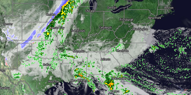
May picked up right where April left off with more great weather in Southern New England. That has hardly been the case in other parts of the country this spring. The front range of the Rockies picked up more snow on Wednesday, and the storm system extended into the Upper Midwest. The Gulf Coast and Florida were plagued by locally heavy rain from a slow moving system that will bring more drenching showers in the next couple of days. Meanwhile, the weather over New England could not be quieter, with high pressure in control and seasonably warm afternoon temperatures.

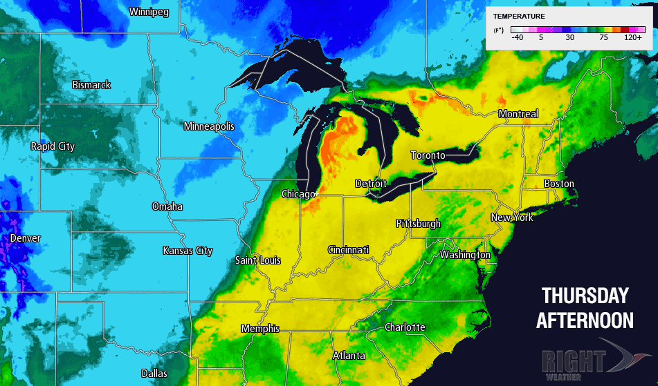
It will be a sunny start on Thursday with the temperature climbing from the 30s and low 40s into the low to mid 50s by mid-morning. The sun will stick around through midday, and a warmer southwesterly breeze will allow the temperature to reach the low 70s inland during the afternoon. It will be in the low to mid 60s near the coast. A back door cold front will be sliding down the Maine coast Thursday afternoon, and it should move through Southern New England by mid-evening. When the front passes, there will likely be some clouds and the wind will shift to the northeast and become gusty. The northeast wind will be between 10-20 mph, and it will drop the temperature by 10-15 degrees a few hours after the front passes.

Friday looks mostly sunny, but cooler, with highs in the upper 50s to low 60s. The dry weather pattern will hold through the weekend, and both days look spectacular. Highs will be in the mid to upper 60s inland, and closer to 60 near the shore due to afternoon sea breezes. At night, the temperature will fall into the 30s to low 40s under clear skies. Both Saturday and Sunday should be sunny or mostly sunny.
The dry stretch is showing signs of ending in the early to middle part of next week. The storm that will slowly move through the Southeast over the next few days may get far enough north to bring some rain by Tuesday and/or Wednesday.


