The high temperature has averaged near 90° away from the coast over the past four days. A strong cold front will bring showers and cooler weather to Southern New England, and the average high temperature during the coming week is likely to be a lot closer to, possibly below, the normal high in the mid 70s.
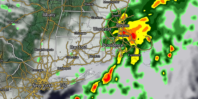
Scattered showers and storms are likely Sunday night in Southern New England. The rain will become widespread Monday morning, with the chance of some embedded thunderstorms. The temperature will be in the mid to upper 60s Monday morning. Showers may continue off and on during the afternoon. The high temperature will be in the upper 60s near the coast, and low to mid 70s inland. The wind will shift from the southwest to northwest Monday evening as the front moves offshore.
The midweek weather will be pleasant. There should be plenty of sunshine, low humidity, and highs in the 70s. The low temperature will be in the 50s, and possibly the 40s for a night or two in the countryside. The wind will gradually come around from west-northwest on Tuesday to easterly by Thursday as high pressure slides offshore.
From Barbara to Andrea?
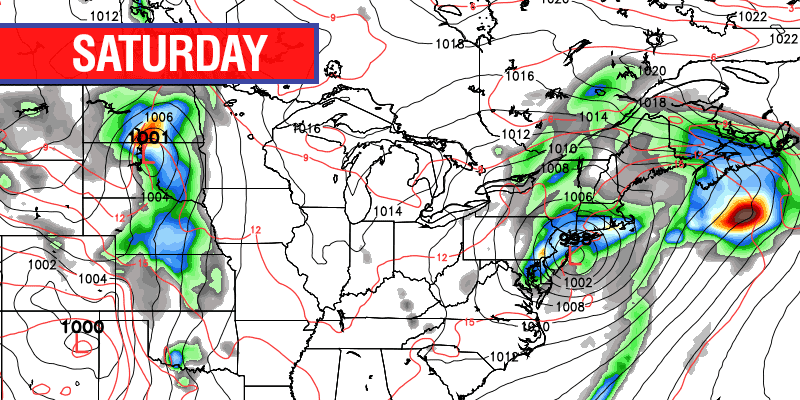
While Southern New England is experiencing a nice midweek stretch of weather, there will be a storm in the slow-cooker in the Gulf of Mexico. It is possible that it will become Tropical Storm Andrea. The storm was originally Hurricane Barbara in the Eastern Pacific. It crossed Central America and weakened, but may restrengthen in the Gulf of Mexico. The late-week forecast has the storm being drawn north by a jet stream disturbance moving through the Midwest. The result is an increase in cloud cover on Friday, followed by rain into next weekend. At this point, it looks like the rain, which could be heavy, will threaten from late-Friday through Saturday. Right now, the outlook is for better weather on Sunday, but the forecast is not very high confidence. Check rightweather.com for updates throughout the week.


