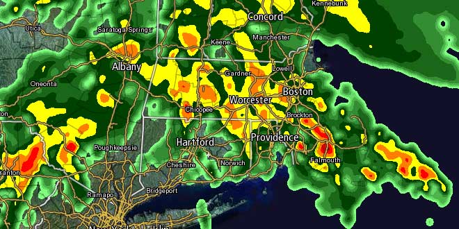
There will not be a very long break between heavy rain showers in Southern New England. Showers and thunderstorms were developing Monday morning over the Mid-Atlantic and spreading northeast toward Southern New England. Scattered showers are likely Monday afternoon, with a round of heavier rain likely Monday night. There will be embedded thunderstorms in the widespread rain as muggier air tries to surge into New England. The National Weather Service has posted a Flood Watch for most of Southern New England except the Cape and Islands from Monday evening through Tuesday evening.
The heaviest showers are likely to occur in the mid to late evening hours on Monday. There is the potential for some 1″ per hour rainfall rates in any thunderstorms, and that heavy rain combined with the 3-5″ of rain that fell last last week may be enough to lead to renewed street, stream, and river flooding. The Pawtuxet River in Cranston, RI was still experiencing minor flooding at midday on Monday, and it is expected to remain near or slightly above flood stage for the next couple of days due to the additional rain that will fall between late Monday and late Tuesday.

The widespread rain associated with a warm front will most likely move through Southern New England by early Tuesday morning, but another round of showers and storms is possible Tuesday afternoon as a cold front approaches. The best chance of seeing rain on Tuesday afternoon is away from the coast. It will be a mostly cloudy, mild, and muggy day, with highs in the 70s. Drier weather is in the forecast for Wednesday and most of Thursday, before another system threatens SNE with more showers Thursday night and/or Friday. At this point, it is uncertain if that storm will stay just far enough south to spare CT, RI, and MA more steady rain.


