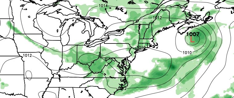
The details of the forecast for this week are very tricky to decipher. The overall weather pattern favors scattered showers and thunderstorms at times in the next 3-4 days, but the timing and location of those showers/storms are rather uncertain. It looks like Monday night will be rainy in most of Southern New England. There is the potential for up to 2″ of rain as vigorous disturbance moves through. It will be mild and muggy, with lows in the mid 60s.
The widespread shower and thunderstorm threat ends early Tuesday morning, and some sunshine is possible Tuesday afternoon. It will be warm and muggy, with highs in the low 80s inland, and mid to upper 70s near the coast. Another disturbance will move through New England Wednesday into Thursday. Scattered showers and thunderstorms are in the forecast for both days, with the greatest likelihood of rain in interior Southern New England. Highs will be in the 70s to low 80s on Wednesday, and in the 70s on Thursday.

The weather should improve on Friday. Look for a blend of clouds and sun, with highs in the 70s to low 80s. Right now, it looks like the weather will be dry for most of the Labor Day weekend, but there are signs that showers could be in the mix for at least one out of the three days. Saturday is shaping up to be partly sunny and warm, with highs in the low 80s inland, and in the 70s near the coast.

A warm front may bring showers/storms on Sunday, followed a cold front with scattered showers on Monday. The forecast is tricky and low-confidence for this weekend. Do not cancel or change any outdoor plans yet. We should have a better handle on what to expect Saturday through Monday by the middle of the week.’
In case you missed it, the Farmers’ Almanac is saying that there is a good chance of a snowstorm during the Super Bowl in New Jersey next February. Click here to find out what we think about the Farmers’ Almanac predictions.


