SATURDAY AM UPDATE
It looks like nothing more than a glancing blow for Southern New England from the storm early next week. Monday should be a breezy day with a few showers as the storm passes well east of New England. The temperature will be in the 60s. Most of next week looks dry, with a warming trend in the midweek. The high temperature inland may flirt with 80° Wednesday and/or Thursday.
FROM FRIDAY PM
Clouds were stubborn over Southeastern New England on Friday. The sky was gray for most of the morning, and the best we could muster in the afternoon were a few sunny breaks. It was on the cool side, with highs in the low to mid 60s. Skies will clear Friday night with lows in the 40s to low 50s early Saturday morning. Saturday will be a delightful day, with plenty of sunshine and highs in the low 70s. There will be a 8-12 mph east-southeast breeze in the afternoon.
Clear skies are likely Saturday night. The temperature will dip into the 40s to low 50s again by Sunday morning. The weather looks great for the third annual Rock ‘n’ Roll Providence 1/2 Marathon. It will be mostly sunny and mild Sunday afternoon. Highs will be in the upper 60s to low 70s. Thin clouds will move late in the day as an ocean storm drifts north.

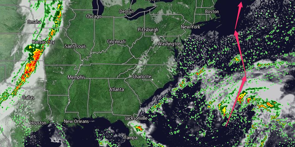
The storm that we’ve followed closely all week on Right Weather Pro looks like it will bring showers and a gusty wind to Southeastern New England Monday into Monday night. The storm is getting organized in the Atlantic Ocean north of the Bahamas. It will slowly move east then north in the next few days. Eventually, it will pass east of Southern New England early next week.
The extent (intensity and duration) of the rain and wind is still uncertain, and we will continue to give updates this weekend. Right now, it looks like the worst weather will be on Cape Cod and the islands – closer to the storm’s center which should stay well offshore. Peak winds could be near 30 mph on the Cape and islands as the storm makes its closest pass.
The storm will move away from Southern New England Tuesday morning, and the outlook for the middle to latter part of next workweek is for dry and warm weather. Highs will be well into the 70s Wednesday and Thursday with mostly sunny skies. Some inland locations may even reach 80° – pretty warm for early October!


